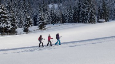
This beautiful hike follows the banks of Klammbach Creek and has you experience amazing scenery at the end of Navis Valley. There is just one brief section with scree and loose rocks underfoot, which you can avoid by taking a detour, climbing slightly higher into the shrub land. That’s part of the adventure. Otherwise, this is a casual snowshoe stroll through a gorgeous winter wonderland. At the game feeding station, which is located slightly beneath the forest road, roe deer often can be seen taking cover when there’s movement on the horizon. If you see wildlife, do not approach; give them lots of space and observe from a distance.


Snowshoe
Starting point
Navis Hut Sledding Track Car Park (elev. 1,400m)
Finishing point
Navis Hut Sledding Track Car Park (elev. 1,400m)
Mountain chain
Tux Alps
Length
10.5 km
Total hiking time
3 h 45 min
Features
- Circular hike
Difficulty rating
medium
Altitude
Elevation uphill 530m
Vertical metres downhill 530m
Trail description
Starting at the car park, follow the forest road that parallels Klammbach Creek to Grünboden. Head to the northern end of Grünboden, cross the creek at the bridge and turn right at the fork. The route continues along the bank of the creek and follows it upstream into the valley. After a while, hikers will approach a tricky section that can be avoided by walking through the shrubs. The trail continues to Vögeleralm Alpine Pasture Hut (elev. 1,660m). Head west briefly, until you reach the signposted forest road where the terrain levels out and continue walking toward Klammalm. After crossing the bridge, a series of switchbacks brings you to a clearing with a few stands of larch trees and a sign indicating "Truppenübungsplatz" (military training area). Reaching the hairpin bend (elev. 1,840m, signposted), leave the trail and head westward. Cross a stile before reaching the bridge over Griffbach Creek (waterfall viewing platform). The final section then passes through sparse forest and eventually merges with the forest road that leads up to Poltenalm Alpine Pasture Hut (elev. 1,880m). From Poltenalm, the route drops down through wide open meadows. A forest road takes you to Navis Hut (elev. 1,767m). From Navis Hut, descend along the sledding track. Take the fork to Schranzberg from the first hairpin bend and head in a northwesterly direction. After descending around 100 metres, the trail merges with a forest road. Please note that a game feeding station is located here slightly beneath the forest road. If you see wildlife, do not approach; give them lots of space and observe from a distance. Once you pass the station the trail drops down through the woods toward Grünboden with the loop bringing you back to the car park.
Please Note: Be prepared to adjust your activity based on current conditions. As a general rule, if there is fresh snow, conditions may be better suited for snowshoeing; if the snow is old and well-travelled, it may be better for winter walking. For avalanche conditions visit lawine.tirol.gv.at.


