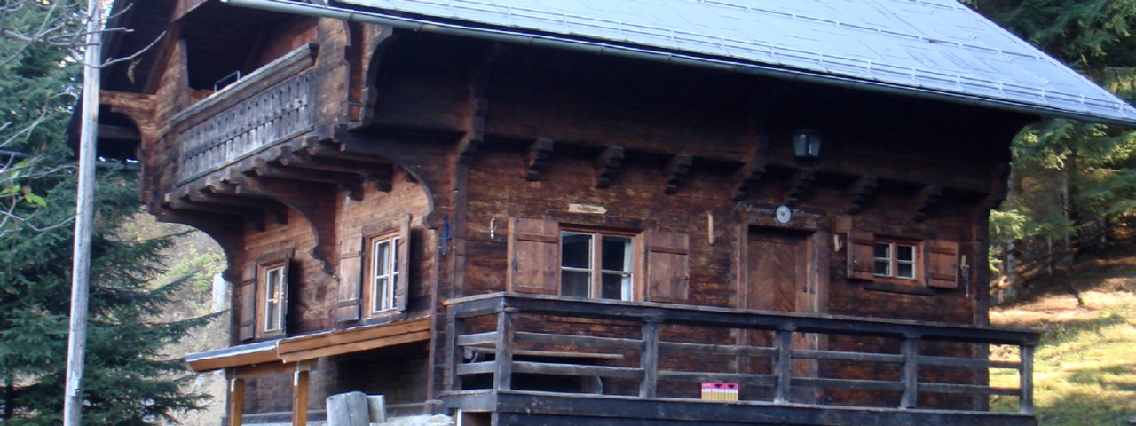
The Vinzenz-Tollinger-Hütte (1,229 metres) is a family-friendly mountain hut open all year located in the northern part of the Tux Alps.
Traditional self-catering hut between Innsbruck and Wattens
Austrian Alpine Club, Hall in Tirol Division
Stone foundations, dark wood, a large balcony on the first floor: the Vinzenz-Tollinger-Hütte near Tulfes is picture-perfect, just the way you imagine an alpine hut to be. It is a self-catering refuge above the Inn Valley, in the northern section of the Tux Alps, sleeping up to 20 people. Both Innsbruck and Wattens are nearby, and the hut's garden (incluing a barbeque area) offers fine views of the Halltal Valley. From the hut it is possible to embark on both short and long walks, either onto the Glungezer mountain or the Patscherkofel south of Innsbruck. There are also a number of other huts in the area serving food and drink. The Vinzenz-Tollinger-Hütte is ideal for large groups and families. Amenities include a kitchen, shower, recreation room and two bedrooms. The perfect place to get away from it all for a few days!
How to get to the hut
From Tulfes in 45 minutes
Walks and hikes in the area (walking time to summit)
Glungezer (2,677 metres), 5 hours, intermediate
Navisjoch (2,479 metres), 5.25 hours, intermediate
Haneburger (2,596 metres), 5 hours, intermediate
Zirbenweg / Patscherkofel (2,246 metres), 5.25 hours, intermediate
Further huts in the area, long-distance hiking trails
Lizumer Hütte, 8 hours
Naviser Hütte, 8 hours
Voldertalhütte, 1 hours
Glungezerhütte, 5 hours
The Vinzenz-Tollinger-Hütte is located on the Via Venezia Alpina long-distance hiking trail (Stage 4), the Munich – Venice Dream Path (Stage 8) and near to the Inn Valley High Trail (Stage 1/Glungezerhütte).
Traditional self-catering hut between Innsbruck and Wattens Austrian Alpine Club, Hall in Tirol Division Stone foundations, dark wood, a large…


