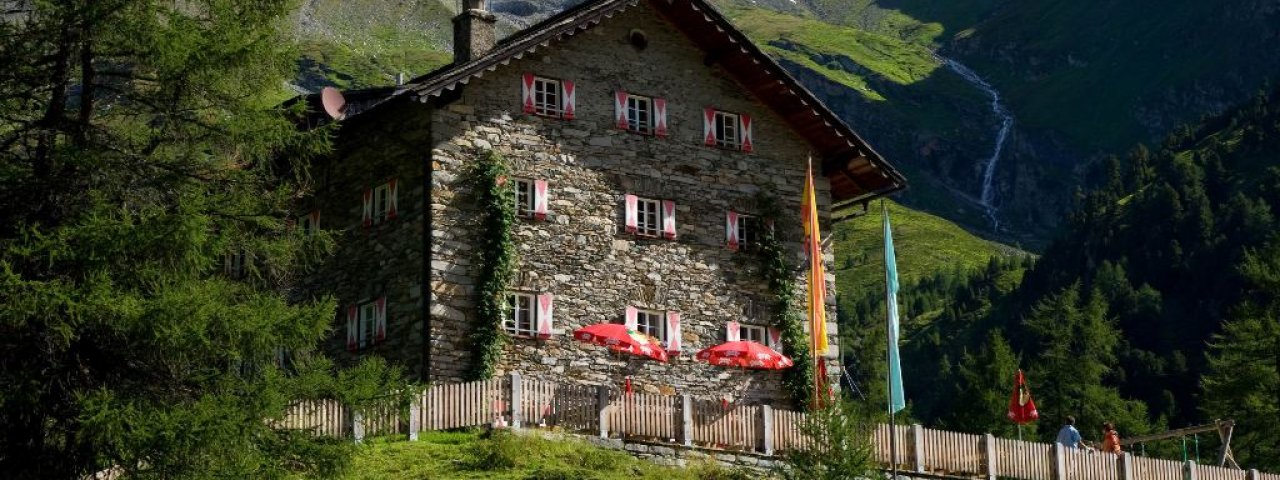
The Kalser Tauernhaus (1,755 metres) is a popular mountain refuge in the Hohe Tauern Mountains of East Tirol and an ideal base for hikes.
Between the Granatspitz and Grossglockner mountains
German Alpine Club, Mönchengladbach Division
Romantic pine forests, alpine meadows, cascading waterfalls and the glaciers of the Glockner and Granatspitz mountains. Even die-hard alpinists catch their breath at the beauty of the mountains in the Hohe Tauern National Park. The Kalser Tauernhaus is also a source of great inspiration: the pleasantly furnished mountain refuge, which was opened by local mountain guides in 1931 as a place to stay for visitors keen to see the Grossglockner mountain, features beautiful wood-panelled dining rooms and comfortable sleeping quarters. It is also suitable for multi-day stays and residential courses. The Kalser Tauernhaus has been able to secure three coveted awards: the "Environmental Seal of Quality", "Family-Friendly Hu"t and "So schmecken die Berge" ("That’s what mountains taste like") culinary award, which guarantees the predominant use of local produce.
How to get to the Kalser Tauernhaus
From Kals in 2.5 hours, from Gasthof Taurerwirt in 1.5 hours. Details on hiking route, from Alpinzentrum Rudolfshütte in 3.5 hours, from Großdorf in 2 hours
Walks and hikes in the area
Dorfersee (1,935 metres), 1 hours, intermediate
Spinewitrol (2,483 metres), 2.5 hours, intermediate
Adlerspitze (2,989 metres), 4.5 hours, difficult
Medelzkopf (2,761 metres), 4 hours, intermediate
Schwarzsee (2,602 metres), 3.5 hours, intermediate
Further huts in the area, long-distance hiking trails
Berghotel Rudolfshütte, 3.5 hours
Stüdlhütte, 5.5 hours
Sudetendeutsche Hütte, 4.5 hours
The Kalser Tauernhaus is the finishing point of Stage 7 and the starting point of Stage 8 of the Eagle Walk in East Tirol, a long-distance hiking trail crossing the region in 33 stages.
Between the Granatspitz and Grossglockner mountains German Alpine Club, Mönchengladbach Division Romantic pine forests, alpine meadows,…


