The Gufferthütte (1,475 metres) is a mountain hut in the northern section of the Rofan Mountains. It is ideal for day hikes and as a basecamp for exploring the surrounding Brandenberg Alps.
Family-friendly basecamp with an Etruscan history
German Alpine Club, Kaufering Division
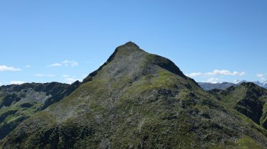
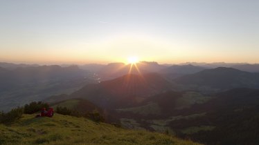
Surrounded by meadows and forests, perched high on a plateau above the valley floor, the Gufferthütte is a great place for a day out as well as for longer stays. There are archaeological finds in the area which date back to the Etruscans. The hut offers fine views of the alpine foothills in Bavaria as well as the craggy peaks of the Rofan Mountains and the Karwendel Mountains. Nearby mountains include the Guffert (which gives the hut its name) and a challenging hike over the Schneidjoch ridge. Rock climbing routes of intermediate difficulty can be found on the Abendstein mountain. Advanced and expert climbers can challenge themselves on the Guffert mountain with its sheer rock faces. The hut, which sleeps 57 guests in a mixture of private rooms and dormitories, is open from mid-May until October. The food served is hearty and traditional.
How to get to the Gufferthütte
From Achenkirch/Steinberg (Köglboden car park) in 2 hours, from Wildbad Kreuth in 3.5 hours, from Kaiserhaus / Brandenbergtal in 4.5 hours, MTB ride to Guffert mountain from Kaiserhaus in Aschau in 4.5 hours.
Walks and hikes in the area (walking time to summit)
Halserspitze (1,863 metres), 1.75 hours, intermediate
Schneidjoch (1,810 metres), 1.75 hours, intermediate
Guffert (2,196 metres), 4.25 hours, schwierig
Etruscan engravings (1,500 metres), 1 hours, intermediate
Abendstein rock climbing area (1,596 metres), 1.25 hours, intermediate
Further huts in the area
Bayreuther Hütte, 9 hours
Erfurter Hütte, 9 hours
Tegernseer Hütte, 7 hours
Family-friendly basecamp with an Etruscan history German Alpine Club, Kaufering Division Surrounded by meadows and forests, perched high on a plateau…


