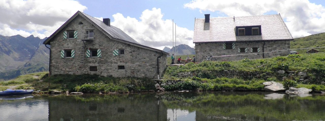
The Friedrichshafener Hütte (2,138 metres) lies in the Verwall Mountains. It is a cosy hut which welcomes families and is an ideal base for those wishing to explore the surrounding region.
The approach to this hut is a beautiful experience, taking walkers and hikers through flower-filled meadows and a rushing stream to the Friedrichshafener Hütte. Situated on an area of land known as the Muttenalpe at the end of the Paznaun Valley, it offers wonderful views of not only the Verwall Mountains but also the eastern peaks of the Silvretta Mountains. This traditional hut above the villages of Ischgl and Galtür is open from late June until early October and is known for its excellent food. It offers 48 sleeping places in a mixture of rooms and dormitory-style areas with matresses next to each other. Families are welcome. In winter there is an unheated room large enough for ten people. Originally built in 1908, the hut was purchased by the Friedrichshafen Division of the German Alpine Club in 1922 and has been renovated and enlarged on several occasions since then, including in 1964 and 1987/88.
How to get to the hut
From Galtür 2.75 hours, from Mathon 2.25 hours.
Walks and hikes in the area (walking time to summit)
Hohe Köpfe (2,608 metres), 1.75 hours, intermediate
Gaisspitze (2,779 metres), 2.5 hours intermediate
Vertinesberg (2,855 metres), 2.5 hours, intermediate
Georg-Prasser-Weg: cicrular hike over the Vertinespleiskopf (2,706 metres) and Schafbichljoch (2,636 metres), 4 hours, intermediate
Further huts in the area, long-distance hiking trails
Darmstädter Hütte, 5,5 hours
Neue Heilbronner Hütte, 4 hours
Konstanzer Hütte, 4 hours
The Friedrichshafener Hütte is located on the Paznaun High Trail (Stage 5/6).
The approach to this hut is a beautiful experience, taking walkers and hikers through flower-filled meadows and a rushing stream to the…


