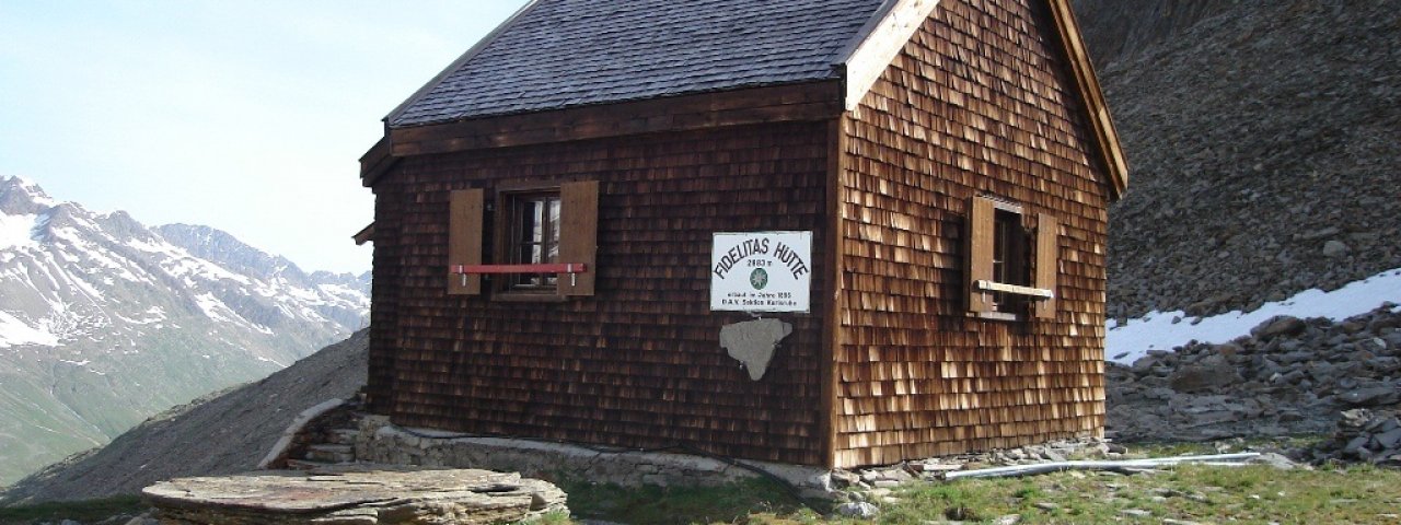
The Fidelitashütte (2,883 metres) is a self-catering hut offering walkers and hikers in the Ötztal Alps protection from the elements.
Emergency shelter by the Gurgler Ferner glacier at the end of the Ötztal Valley
German Alpine Club, Karlsruhe Division
The glacier landscape of the Gurgler Ferner at the end of the Ötztal Valley is for hardcore mountaineers only. It will therefore come as little surprise that this hut in the heart of the terrain is pretty basic: no water, no electricity, no toilet. The Fidelitashütte is a self-catering hut designed to provide walkers, hikers and climbers in the area with protection from the elements. You will need to bring your own food; the Hochwildehaus hut next door will remain closed for the forseeable future. Approaching from the village of Obergurgl, the hut lies on the eastern edge of the Gurgler Ferner glacier. It was built in 1896 and sleeps 12 people. The closest other hut which is open is the Langtalereckhütte around 1.5 hours away. Both huts form part of the Ötztal Trek (Stage 10).
How to get to the hut
From Obergurgl via the Langtalereckhütte (4 hours).
Walks and hikes in the area (walking time to summit)
Schalfkogel (3,540 metres), 4 hours, schwierig (glacier equipment required)
Hochwilde (3,458 metres), 3.5 hours, schwierig (glacier equipment required)
Annakogel (3,333 metres), 2.5 hours, schwierig (glacier equipment required)
Further huts in the area, long-distance hiking trails
Langtalereckhütte, 1.5 hours
Ramolhaus, 3 hours
Martin-Busch-Hütte, 6 hours
The Fidelitashütte is located on the Ötztal Trek (Stage 10).
Emergency shelter by the Gurgler Ferner glacier at the end of the Ötztal Valley German Alpine Club, Karlsruhe Division The glacier landscape of…


