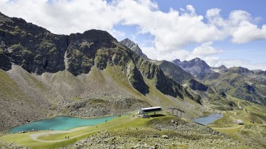
The Neue Alphütte hut is a self-catering hut at 1,506 metres above sea level on the south-facing slopes of the Mieming Mountains. It is an excellent base for challenging walks and hikes.
Self-catering hut for outdoor adventurers
German Alpine Club, München & Oberland Division
The Alpltal Valley, home to the small but perfectly formed Alplhaus hut, opens up in an easterly direction towards the town of Telfs and is bordered to the north by the highest peaks of the Mieming Mountains. Many visitors are drawn to the hut by the excellent walking, climbing and hiking on offer in these mountains. Families will also find plenty of easier routes. The hut itself is basic but has everything you need, including a kitchen with a stove, crockery and solar energy. Drinking water can be collected from a spring around 10 minutes away. If you're not in the mood for cooking, there is a hut, the "Neue Alplhütte", just 100 metres away. This hut also has a large play area for children.
How to get to the hut
From Telfs via Klammsteig trail: 3 hours
From the Straßberg car park: 1.5 hours
From Telfs through the Rinnertal Valley: 3 hours
From Wildermieming via Ochsenbrünnl: 2 hours
Walks and hikes in the area
Wetterkreuz (1,920 metres), 2.5 hours, intermediate
Circular hike Judenkopf and Zwölferköpfe, 4.5 hours, intermediate
Hohe Munde, western summit (2,659 metres), 7.5 hours, difficult (via ferrata climbing equipment required)
Hochwand (2,719 metres), 7 hours, difficult
Hochplattig (2,768 metres), 8 hours, difficult
Other huts in the area
Tillfussalm and Gaistalalm, 3.5 hours
Self-catering hut for outdoor adventurers German Alpine Club, München & Oberland Division The Alpltal Valley, home to the small but…


