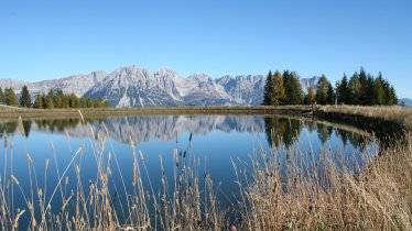
This hike in the Kaiser Mountains is dominated by the 2,304-metre-high Treffauer. The peak itself is difficult to climb and therefore for experts only, but this alternative route is suitable for everyone and takes in many pastures, meadows and huts around the foot of the mountain. We recommend a stop at the charming Riedlhütte (1,268 metres) with its sunny terrace and cosy wood-panelled rooms. The hike takes around 4.5 hours to complete and begins an ends in the village of Scheffau (883 metres).

Circular Hike
Starting point
Jägerwirt, Scheffau
Hike to
Wegscheidalmen, Riedlhütte
Finishing point
Jägerwirt, Scheffau
Mountain chain
Kaiser Mountains
Length
10.7 km
Total hiking time
4 h 30 min
Features
- Wheelchair-accessible Hiking Route
- Circular hike
Difficulty rating
intermediate (red mountain trails)
Altitude
Elevation uphill 653m
Vertical metres downhill 653m
Fitness level
Technique
Best time of year
* These are approximate values and recommendations. Please take your personal fitness level, technical ability and the current weather conditions into account. Tirol Werbung cannot guarantee that the information provided is correct and accepts no liability.
Public transport
- Accessible using public transport
Bus route 4060, get off at stop Scheffau a. W. K. Dorf
Parking
Parking available at the Jägerwirt in Scheffau
Places serving food & drink
- Riedlhütte (June until September)
- Jägerwirt (Wednesday until Sunday)
Downloads
Trail description
The adventure begins at the Jägerwirt in Scheffau. Head right along a small road. Then, after passing a barrier across the road, take the trail up to the Wegscheid-Niederalm, an old hut where today all you will find is a barn. The hut itself was carried away by an avalanche in 2012. This first part of the hike is relatively easy and takes around 45 minutes to complete. From the former hut you can either stay on the easy forest road or take the more direct route up through a series of meadows to the Wegscheid-Hochalm hut (1,212 metres). Please be aware that the hut is closed to the public and does not serve food or drink. From here the trail heads left and at some point splits in two. You need to follow the Wilder-Kaiser-Steig (WKS) heading right towards the Gruttenhütte. The trail leads for about an hour through mountain pine shrubs and partly through sparse forest and over scree fields in a varied up and down to the road leading to the Gruttenhütte (1,620 metres). This is a good place to stop for a rest. The trail is always on the west and south side of the Treffauer-Tuxeck massif. On the Gruttenhütten farm trail, the route now descends to the right for around two hundred metres to the Riedlhütte (1,228 metres). The highest point of this circular hike (1,446 metres) has already been passed at this beautiful and popular resting place, where you can stop for a bite to eat. From now on, there are only just over three hundred metres of downhill to go. The route follows a gentle road downhill via the Buchauer and Stoabrandalm pastures, passing through an extensive wooded area. The path then leads across a meadow to the hamlet of Kaisern. Now take a short stretch on an asphalt road to the Gregglberg forest and then follow the hiking trail down to Steinacker (875 metres). Keep right here and walk down to a bridge or over a footbridge up the short ascent to the Jägerwirt and you have reached the starting point.


