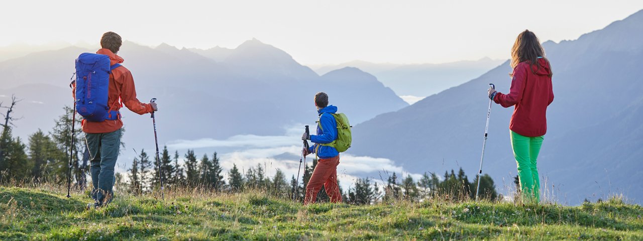
The highlight of this two-day trek of intermediate difficulty is the Tschirgant mountain (2,370 metres). Seen from the south-west, this mighty peak rises high above the Inn Valley and the Gurgltal Valley. The views from the top of its summit are fantastic. The hike begins in the village of Obsteig on the Mieming Plateau, leading through a forest up to the Simmering-Alm hut. The first peak of the day is the Simmering (2,096 metres). Hikers then stay the night at the nearby Haiminger Alm hut. Early risers can enjoy the beautiful dawn light on the north-eastern ridge the next morning. Sections of this ascent to the Tschrigant mountain are steep, but all in all it poses no major difficulties. Hikers will nevertheles need to be sure footed and have a good head for heights – especially if they decide to take the steep and difficult western approach instead of the easier north-eastern vairation.

Starting point
Obsteig
Hike to
Haiminger Alm, Tschirgant
Finishing point
Imst
Length
24.5 km
Duration
2 day(s)
Features
- Wheelchair-accessible Hiking Route
- Circular hike
Altitude
Elevation uphill 1,780m
Vertical metres downhill 2,025m
Public transport
- Accessible using public transport
Parking
Local authority building ("Gemeindeamt") or parish church in Obsteig.
Places serving food & drink
- Stage 1: Simmering-Alm (May until late October: daily, April: Friday until Sunday), Haiminger Alm (second half of June until mid-September)
- Stage 2: Karröster Alm (1 May until late October), Gasthof Trenkwalder (Karrösten), various locations in Imst
Trail description
Stage 1: Obsteig – Haiminger Alm
Uphill/downhill: 1,130/365 vertical metres, walking time: 5,5 hours, distance: 8.6 kilometres, highest point: 2,096 metres, difficulty: intermediate (red)
Make your way from the western end of Obsteig, opposite the Hotel Bergland, along the access road that leads from the main road to Grünberg Lifts. Then turn right, heading towards the Simmering-Alm hut. Continue in the same direction on a narrower dirt road through the forest. Some distance beyond, bear right following signs for “Alpsteig”. Continue for a while on a dirt road before the real Alpsteig path begins. The path heads straight up across mostly steep terrain through a forest and ends a few metres below the Simmering-Alm hut. At an altitude of around 1,700 metres the path turns onto a forest road that quickly takes you up to Simmering-Alm hut, which soon becomes visible. Right before the hut, turn left onto the path to “Haiminger Alm”. Now, ascend on the poorly defined path (sometimes only a rolling singletrack trail can be found) across meadows and hollows. Pass the water catchment to the right and turn left into the dwarf pines. Thereafter, ascend across a kind of ridge and then walk over to the summit of the Simmeringjoch saddle that features a cross. Continue in the same direction (“Haiminger Alm”) and gently descend along the spine of the ridge. The route crosses a little incision, followed by a short counter-ascent to the Zunterkopf mountain, a kind of mountaintop that is strewn with dwarf pines. Thereafter, the route descends again and finally runs over to the Haiminger Alm hut on a dirt road.
Stage 2: Haiminger Alm – Tschirgant – Imst
Uphill/downhill: 650/1,660 vertical metres, walking time: 7.5 hours, distance: 16.3 kilometres, highest point: 2,370 metres, difficulty: intermediate (red)
Start off at the Haiminger Alm hut and ascend the slope on a way-marked trail. From the beginning, the route gently climbs across marvelous meadows in a forest on the ridge that divides the Inn Valley and the Gurgltal Valley. Thereafter, the path enters dwarf pines and ascends to a small foresummit of the Tschirgant mountain with the "Haiming Cross" on its top. From here, the terrain becomes more rugged. Walk over to the fork that is marked by trail signs (this section has some descents). Then, continue in the same direction and gently ascend on a well-maintained trail right below the ridge and partly on the ridge across grass-strewn rubble flanks and rocky terrain to the (main) peak of Tschirgant mountain with the "Karres Cross" on its top. A short distance below is where you will find "Karrösten Cross" (the crosses on the summit are named after the villages of Karres and Karrösten). Thereafter, retrace your steps to the fork, but this time follow the sign for “Karröster Alm”. The trail leading to this alpine hut branches off to the left only a few metres east of the sign. The trail soon enters a forest and descends steeply for a while before easing off and heading westwards. At an altitude of around 1,650 metres you will reach a dirt road that you have to cross. Beyond, follow the trail that descends through the forest down to the Karröster Al, hut. From the hut, walk down on a rolling singletrack trail across meadows before gently descending on the trail through woods, which turns onto a forest road at an altitude of around 1,200 metres. Continue your descent on the forest road, where the route once again passes the information stations of the Karrösten Geo Learning Trail (“Geolehrpfad Karrösten”). Shortly after, switch onto the broad footpath ("Karrösten") which merges onto the forest road again after a while. Descend, passing the parking area where you can also find information on the learning trail. At the following fork, descend to the right heading towards Karrösten. Having reached the village, continue your descent in the same direction (passing the first option to branch off to Imst). At the Weberei Schatz weaving mill, walk down to the local authority building ("Gemeindeamt"), where you turn right towards Imst. Now, descend on a trail and dirt road across meadows and through woods, constantly heading towards Imst. Having reached the valley bottom with its stream, continue in the same direction. Finally, cross the stream and ascend to the town centre.
Return to the starting point in Obsteig (via Nassereith) using the bus service operated by the ÖBB-Postbus.
Tip! Use the opportunity to visit the Laurentius-Kirchl chapel on the "Bargl" hill. It was constructed on Roman foundations and is the oldest place of worship in North Tirol. The Gothic parish church (“Assumption of Mary”) has an 86-metre-high spire which is the highest in North Tirol and the third-highest in Austria.


