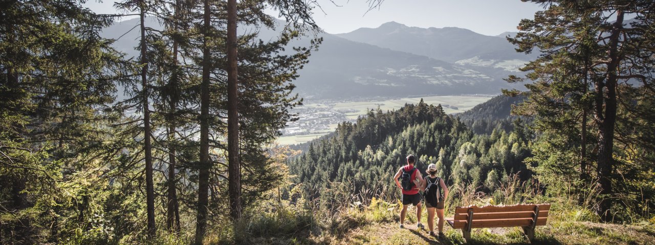
Five stages, 88 kilometres and plenty to see along the way – the Tirol Silver Trail is a long-distance hike taking in all twelve villages in the Karwendel Silver Region and giving walkers an insight into its long and proud history of silver mining. The trails are relatively easy, but hikers will need good overall fitness to complete the route from start to finish. Most of the hiking is at intermediate altitudes to the north and south of the Inn Valley, taking in fortresses, gorges, places of pilgrimage and suspension bridges as well as plenty of shady forests and lush meadows. There are plenty of good places to stay the night en route. The stages of the Tirol Silver Trail can be hiked in various different orders and can also be hiked one at a time.

Long-Distance Hike
Starting point
Jenbach railway station
Finishing point
Jenbach railway station
Mountain chain
Tux Alps
Karwendel Mountains
Length
87.8 km
Duration
5 day(s)
Features
- Wheelchair-accessible Hiking Route
- Circular hike
Difficulty rating
intermediate (red mountain trails)
Altitude
Elevation uphill 3,500m
Vertical metres downhill 3,500m
Fitness level
Technique
Best time of year
* These are approximate values and recommendations. Please take your personal fitness level, technical ability and the current weather conditions into account. Tirol Werbung cannot guarantee that the information provided is correct and accepts no liability.
Public transport
- Accessible using public transport
REX, RJX, S-Bahn, IC/EC, ICE (Jenbach railway station)
Parking
Jenbach railway station
Places serving food & drink
- Stage 1: Bio Bauernladen Jenbach, Schlosswirt Tratzberg, Wallfahrtskloster St. Georgenberg, Puitner Stüberl
- Stage 2: Schmalzerhof, Hotel Rettenberg, Gasthof Steixner, Biosennerei Kolsass
- Stage 3: Jausenstation Gartlach, Hotel Pension Jägerhof, Astl’s Bauernladen, Landgasthof Schwannerwirt
- Stage 4: Burg Freundsberg, Gasthof Tippeler, Gasthof Einhorn Schaller, Hotel-Gasthof Goldener Löwe, Knappenkuchl, Restaurant Silberberg
- Stage 5: Bauernladen Siegismund & Müller, Hofladen Pirchnerhof, Hofladen Kohlerhof Danzl, Gasthof Esterhammer
Trail description
Stage 1: Jenbach – Stans – Vomp
Uphill/downhill: 750/410 vertical metres, walking time: 6 hours, distance: 18.8 kilometres, difficulty level: intermediate
The first stage starts at Jenbach railway station with a short detour to the parish church, which has played a significant role in the region's mining history. The trail then continues west along the Inn river, through the Tratzberger Au to the famous Tratzberg Castle, where guided tours take place daily. Hikers then enter the forest above the valley floor, with the now leading to the Maria Tax pilgrimage chapel and the St. Georgenberg monastery, Tirol's oldest place of pilgrimage. Below these buildings it is possible to cross the imposing Wolfsklamm gorge via the "Hohe Brücke" bridge. Following the Alpsteig trail for about six kilometres and you will reach Vomperberg, where overnight accommodation is available, or you can continue on to the larger village of Vomp.
Stage 2: Vomp – Terfens – Weer/Kolsass
Uphill/downhill: 485/790 vertical metres, walking time: 5.5 hours, distance: 15.7 kilometres, difficulty level: intermediate
From Vomperberg the trail initially leads through an area known as the Vomperloch, a gorge-like valley with its own a hydroelectric power plant (Important! There is currently a detour on the trail there, please follow the signs). On the other side you climb up towards Umlberg. Continue on the Panoramaweg trail, then on the Jakobsweg trail through the idyllic Larchtal Valley to the pilgrimage church of Maria Larch its fountain said to contain healing waters. Then hike south through Terfens, cross the Inn river, and shortly afterwards you will reach the village of Weer. Accommodation is available there and in neighboring Kolsass.
Stage 3: Weer/Kolsass – Kolsassberg – Weerberg
Uphill/downhill: 645/330 vertical metres, walking time: 5 hours, distance: 13 kilometres, difficulty level: intermediate
Stage three begins with a climb of just under 650 vertical metres. From Kolsass, the route leads through the Rohrbachwald forest on a fairly steep serpentine road to Kolsassberg, past the Jausenstation Gartlach snack station and the disused "Reindlmühle" mining shaft. The road then turns downhill again, and before reaching Weerberg, the destination of the day, the wild Weerbach stream must be crossed via a suspension bridge. Sights worth a visit in Weerberg include the parish church and the Rablhaus Museum.
Stage 4: Weerberg – Pill – Schwaz
Uphill/downhill: 805/1,142 vertical metres, walking time: 7.5 hours, distance: 19.6 kilometres, difficulty level: intermediate
Stage four is the longest of the Tirol Silver Trail and also takes hikers to the highest point on the route. From Mitterweerberg, follow the road to the southeast into the forest and then uphill. The next section traverses above the settlements of Weerberg mountain on the northern flank of the Gilfert mountain, crossing several streams, to the highest point (at almost 1.500 metres above sea level), which lies on the western side of the Zintberg mountain. Again and again there are wonderful views of the Inn Valley. Hikers then continue through the village of Pill and past the Kellerjochbahn cable car before heading down to Schwaz, the largest town in the region with a vibrant cultural scene.
Stage 5: Schwaz – Gallzein – Buch in Tirol – Jenbach
Uphill/downhill: 735/750 metres, walking time: 7 hours, distance: 18.6 kilometres, difficulty level: intermediate
On the last stage, the route leads uphill once again, through the Silberwald forest above the town of Schwaz and along the Schwazer Knappensteig trail, where mining relics can be seen. At an altitude of over 1,000 metres the route crosses the municipal area of Gallzein and Hochgallzein with its many farmsteads. The route then descends to Buch in Tirol and past the ruins of Rottenburg Castle, once one of the most important noble residences in Tirol. A few hundred metres before the ruins there is a special tree, the Notburga Spruce, which is considered the tallest spruce tree anywhere in Tirol. The route continues through Rotholz to a bridge over the Inn river. On the other side of the river it is just a question of completing the final few kilometres to the finishing point at the railway station in Jenbach.


