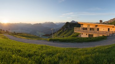
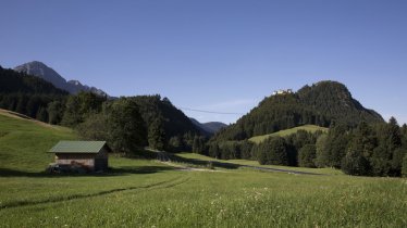
This three-day trek takes hikers across the Reutte Nature Park Region, from the Hahnenkamm mountain above Pflach all the way to Pinswang near the German border. Day one leads over two mountains above 2,000 metres: the Schneid (2,009 metres) and the Gehrenspitze (2,163 metres). Both offer fine views of the valley around Reutte and the Lech river. After staying the night at the Gehrenalpe hut, the journey continues via the Musauer Alm hut and the idyllic Reintal Valley to Pflach. The highlight of the third and final day is the ascent of the Säuling mountain (2,047 metres), situated on the border between Austria and Germany. The summit has fine views over the border into Bavaria with its Ostallgäuer Seen lakes and fairytale-like castles. The rest of the hike is rated intermediate, but this final climb is challenging. HIkers must be sure-footed in order to negotiate the exposed sections.

Starting point
Car park at bottom of cable cars in Reutte
Finishing point
Gutshof zum Schluxen in Pinswang
Mountain chain
Ammergau Alps
Length
35 km
Duration
3 day(s)
Features
- Wheelchair-accessible Hiking Route
- Circular hike
Difficulty rating
difficult (black trails)
Altitude
Elevation uphill 2,200m
Vertical metres downhill 3,110m
Fitness level
Technique
Best time of year
* These are approximate values and recommendations. Please take your personal fitness level, technical ability and the current weather conditions into account. Tirol Werbung cannot guarantee that the information provided is correct and accepts no liability.
Public transport
- Accessible using public transport
Parking
Bottom station of the cable cars in Höfen
Places serving food & drink
- Stage 1: Panorama-Restaurant Hahnenkamm, Lechaschauer Alm (mid-May until late October), Gehrenalpe (mid-May until late October)
- Stage 2: Musauer Alm (late April until late October), Gasthaus Bärenfalle
- Stage 3: Säulinghaus (mid-May until late October), Gutshof zum Schluxen
Trail description
Stage 1: Reutte – Gehrenspitze – Gehrenalpe
Uphill/downhill: 695/815 vertical metres, walking time: 4 hours 45 minutes, distance: 6.3 kilometres, highest point: 2,163 metres, difficulty level: intermediate (red trails)
From the bottom station of the cable cars in Höfen, take the gondola up to the Panorama-Restaurant Hahnenkamm located at the foot of the Hahnenkamm mountain. From there, a trail leads in a northerly direction to the Lechaschauer Alm hut and on to the summit of the Schneid (2,009 metres) offering fine views. From there, descend along a rocky ridge to the Gehrenjoch saddle (1,858 metres) and then climb again in a north-easterly direction to the Gehrenspitze (2,163 metres), the highest point on day one. Descend back along the way you came and, when you get to the Gehrenjoch saddle, turn left towards the Gehrenalpe (1,609 metres). This hut is where you will spend your first night. Those who wish to can first leave their rucksack at the hut and then take on the ascent of the Gehrenspitze.
Stage 2: Gehrenalpe – Musauer Alm – Gasthaus Bärenfalle/Pflach
Uphill/downhill: 290/1,065 vertical metres, walking time: 4 hours 20 minutes, distance: 10.5 kilometres, highest point: 1,855 metres, difficulty level: intermediate (red trails)
After a hearty breakfast at the Gehrenalpe hut, the trail leadsback up over the Gehrenjoch ridge and then northwards to the Musauer Alm (1,290 metres). The descent then continues in a north-easterly direction through the beautifil Reintal Valley, along the banks of the rushing Sababach river. Shortly before reaching the end of the valley, it is worth taking a small detour to the "Achsel" (1,148 metres), a foothill of the Schlicken Massif. The reward is a magnificent view of the Lechtal Valley and the Säuling mountain (2,047 metres) on the opposite side of the valley. Then head back into the Reintal Valley and continue along the path downhill as far as the Gasthaus Bärenfalle. You can stay the night in this hut or in another of the accommodation options in Pflach.
Tip! If you still have some extra energy, take a walk along the delightful Lech River Trail. The bird-watching tower offers amazing views of Europe’s last wild river.
Stage 3: Pflach – Säuling – Gutshof zum Schluxen, Pinswang
Uphill/downhill: 1,195/1,220 vertical metres, walking time: 8 hours 40 minutes, distance: 18 kilometres, highest point: 2,047 metres, difficulty level: difficult (black trails)
The highlight of the final day is the mighty Säuling (2,047 metres. The day begins heading east towards Unterletzen, over the Lech river and in Pflach, just after passing the Gasthof Alpenblick, from the Reuttener Straße road left onto the "Säulingweg" trail. Hikers head through meadows, over the Fernpassstraße road and then along the "Säulingsteig" trail up onto the mountain via its south-westen flank. Around half way up you will reach the Säulinghaus (1,693 metres). The trail is rocky but not particularly difficult. After stopping at the hut for a rest, hikers continue up and will find that the trail becomes more challenging. Sections have steel wires anchored to the rock for safety. Hikers must be sure-footed. As you head south-east, you will reach a ridge and then continue northwards over the lush "Gamswiese". The nearby summit offers great views over the border to Bavaria, including the famous fairytale-like Neuschwanstein Castle. Descend along the way you came until, below the hut, you will find a trail turning off left down the forested western side of the mountain – with great views of the Alpsee lake – to Pinswang and the Gutshof zum Schluxen. Those with energy left can walk around the Alpsee lake.


