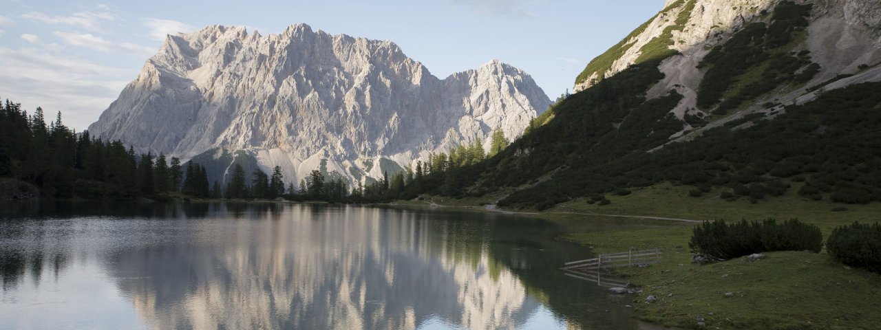
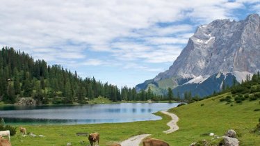
Giving you a good workout, this wonderful trek across the Mieming Mountains requires good endurance and sure footing. The payoff for that work includes excellent trails, glorious views, lush alpine pastures and sparkling lakes. At the foot of the lofty Zugspitze, Germany’s highest peak, the Mieming Mountains offer uninterrupted panoramic vistas. The highlight of this walk is the crystal-clear Seebensee lake next to the Coburger Hütte hut. Take a break, relax and savour your well-earned achievement as your eyes wander from one craggy summit to the next.

Starting point
Martinsplatz square, Ehrwald
Hike to
Coburger Hütte, Obsteig, Marienbergjoch
Finishing point
Martinsplatz square, Ehrwald
Mountain chain
Wetterstein Mountains
Length
31.5 km
Duration
3 day(s)
Features
- Wheelchair-accessible Hiking Route
- Circular hike
Difficulty rating
difficult (black trails)
Altitude
Elevation uphill 2,200m
Vertical metres downhill 2,200m
Fitness level
Technique
Best time of year
* These are approximate values and recommendations. Please take your personal fitness level, technical ability and the current weather conditions into account. Tirol Werbung cannot guarantee that the information provided is correct and accepts no liability.
Public transport
- Accessible using public transport
Parking
In the village centre or at one of the local cable cars such as the "Ehrwalder Almbahn"
Places serving food & drink
- Stage 1: Coburger Hütte (first hald of June until second half of October)
- Stage 2: Lehnberghaus (mid-May until late October.; closed Tue), Gasthaus Arzkasten (open all year; closed Mon & Tue), various locations in Obsteig, including Hotel Bergland, Gasthof Alte Schmiede and Wurscht & Durscht
- Stage 3: Marienbergalm (late April until late October), Sunnalm (second half of May until second half of October, closed Wed), various locations in Ehrwald
Downloads
Trail description
Stage 1: Ehrwald – Seebensee – Coburger Hütte
Uphill/downhill: 950/35 vertical metres, walking time: 3.75 hours, distance: 5.7 kilometres, highest point: 1,920 metres, difficulty: intermediate (red)
In Ehrwald, take the gently ascending village road and follow this for around 1.5 kilometres until you get to a chapel on the right-hand side of the road. Take the signed track (“Kuhmuhle, Coburger Hütte”) and cross the stream. Thereafter, bear left and take the signed forest road heading to “Coburger Hütte, Hoher Gang”. After some 200 metres a track branches off to the right, leading to the Coburger Hütte hut. Follow the track as it climbs gently uphill initially through meadows and a larch forest. Eventually the track becomes steeper and zigzags through rugged terrain in the last section (some sections have a fixed system of steel wires anchored into the rock for safety), taking you to the wide open pastures slightly above the Seebensee lake. From there, a trail descends to the lake. Pass the scenic mountain lake on its eastern side on a relatively level path. Finally, the trail zigzags up to the Coburger Hütte hut in steep switchbacks.
Stage 2: Coburger Hütte – Grünsteinscharte – Obsteig
Uphill/downhill: 395/1,280 vertical metres, walking time: 5 hours, distance: 10.3 kilometres, highest point: 2,272 metres, difficulty: difficult (black)
Behind the Coburger HÜtte hut, the path descends a few metres to the Drachensee lake following signs for “Grünsteinscharte” and then zigzags up the mountain opposite the hut, mainly in switchbacks. Thereafter, the route runs eastwards to a rock-strewn plateau before then continuing towards the Grünsteinscharte ridge (right-hand side). As the track climbs there are glimpses across the south to the ridge. Now, the trail rather gently traverses a cirque and gradually ascends to the point where you cross the mountain. Beyond this point, walk on the singletrack trail that descends down the long and slightly steep (scree) cirque of Höllreise. Stay in the cirque and continue in the same direction (you can branch off towards Hölltörl and Stöttltörl). At the end of Höllreise rock slab, the scree cirque changes into a valley in which dwarf pines (mountain pines) are predominant. From here, the path leads gently out of the valley through fields of dwarf pines. At a water catchment, the path changes onto a dirt road that takes you to the Lehnberghaus lodge within a few minutes. From here, gently descend along a dirt road winding through forest and heading towards the entrance of the valley until you reach the hamlet of Arzkasten, which belongs to the village of Obsteig. At an elevation of 1400 metres you have the option of a shortcut on the right-hand side via an old route. Bear left before the car park in Arzkasten and keep right thereafter (“Mooswald”, “Obsteig”). Now gently descend through dense spruce forest on a broad footpath/dirt road (turn right at the first fork.) Some distance beyond, the route runs right next to a meadow into the hamlet of Mooswald. Walk through the hamlet and down to the main road in Obsteig. There are several hotels and other accommodation options available in Obsteig. It may be worth booking in advance.
Stage 3: Obsteig – Marienbergjoch – Schachtkopf – Ehrwald
Uphill/downhill: 875/890 vertical metres, walking time: 6.75 hours, distance: 16 kilometres, highest point: 1,802 metres, difficulty: intermediate (red)
Retrace your steps and follow the trail back to the “Alpsteig, Marienbergalm” trail crossing, some 300 metres behind the Gasthaus Arzkasten inn. Follow a dirt road as it climbs gently uphill and soon emerges onto a footpath that meanders above a creek into the Marienbergtal Valley. Eventually you will get to the pastures near the Marienbergalm hut. Pick up the dirt road at the hut and follow it up onto the Marienbergjoch ridge (1,800 metres). Beyond the ridge the route winds down through pastures used as ski runs in winter. Shortly before reaching the junction to the Sunnalm Restaurant, a signed trail (“Schachtkopf, Jubiläumsweg”) heads to the right. Follow the track at an elevation of 1650 metres as it undulates through a wide open cirque. As the trail proceeds there are glimpses across to the lofty Schachtkopf peak. This section of the trail has a number of information stations with details of the area's long mining tradition. At the Schachtkopf peak the trail starts to descend further. Follow the signage to “Biberwier” until you reach a game feeding area. This is where the track turns onto the Panoramic Trail, a northbound forest road that will take you back to Ehrwald.


