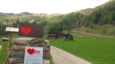
This hike takes in one of the most beautiful lakes in East Tirol, a mighty mountain peak, a pretty traditional village and plenty of wooden huts. All in all, hikers will be walking for seven hours and must be both fit and sure-footed to complete the mountain ascent. However, all that hard work is certainly worth it. The views which await at the top of the 2,774m Riepenspitze are spectacular and stretch all the way to the Sexten Dolomites, Hochgall, Venediger Mountains and Glockner Mountains.

Summit Hike
Starting point
Unterstalleralm, Villgratental
Hike to
Riepenspitze
Finishing point
Unterstalleralm, Villgratental
Length
12.6 km
Total hiking time
8 h 15 min
Features
- Wheelchair-accessible Hiking Route
- Circular hike
Altitude
Elevation uphill 1,260m
Vertical metres downhill 1,260m
Public transport
- Accessible using public transport
Parking
Unterstalleralm (6.5 kilometres from Innervillgraten)
Places serving food & drink
Unterstalleralm (open from Whitsun until around mid-October)
Downloads
Trail description
This hike begins at the Unterstalleralm in Innervillgraten (1,664 metres). From the small chapel, hikers cross the Arntaler Bach stream and continue along the steep trail number 15 to the Restlangarten with its stone cattle shelter surrounded by fields of mountain roses (2,241 metres). From here, hikers stay left and wind their way up along several switchbacks to the sparkling Schwarzsee lake (2,455 metres) hidden from sight. The path to the Riepenspitze mountain passes along the right-hand side of the lake and then turns off left. Stone steps, mighty rocks, small ponds and the Hintere Gsieser Lenke all feature as walkers make their way to the northern ridge of the Riepenspitze mountain. The final section of the ascent then leads up onto the summit with its mighty cross at 2,774 metres above sea level.
From the summit, hikers return along the trail they came from as far as the Restlangarten. Here, they turn left onto trail 15a and descend steeply between pine and alder trees before reaching wide open meadows and a cross. One option here would be to take the trail coming from the Villgratner Törl heading west towards the Unterstalleralm, which takes around half an hour. However, there is another attraction to be seen: the charming wooden huts of the Oberstaller Alm. To reach these, hikers must walk in an easterly direction along a path which gradually becomes wider. After crossing a forest and passing many rocks they reach the Oberstaller Alm, a small village of traditional wooden huts with the white Schutzengel-Kapelle chapel at its heart (1,857 metres). From here is takes around an hour to walk back down along the tarmac road to the starting point at the Unterstalleralm.


