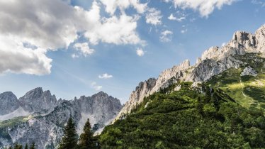
This easy circular hike at the foot of the mighty Kaiser Mountains is ideal for those who like their walks nice and relaxing. It takes in a traditional hut, the Ackerlhütte (1,465 metres), and leads past the thundering Schleierwasserfall, one of the most beautiful waterfalls in Tirol. The area around the waterfall is also popular with rock climbers. Views of the Kaiser Mountains with peaks up to 2,344 metres accompany walkers all the way from the start in Hüttling (816 metres).

Circular Hike
Starting point
Car park in Hüttling
Hike to
Schleierwasserfall, Ackerlhütte
Finishing point
Car park in Hüttling
Mountain chain
Kaiser Mountains
Length
9 km
Total hiking time
4 h 30 min
Features
- Wheelchair-accessible Hiking Route
- Circular hike
Difficulty rating
intermediate (red mountain trails)
Altitude
Elevation uphill 682m
Vertical metres downhill 682m
Fitness level
Technique
Best time of year
* These are approximate values and recommendations. Please take your personal fitness level, technical ability and the current weather conditions into account. Tirol Werbung cannot guarantee that the information provided is correct and accepts no liability.
Public transport
- Accessible using public transport
Bus route 4060, get off at stop Going a. W. K. Hüttling
Parking
The Hüttling car park is only used as a day car park and is subject to charges. It is forbidden to park there overnight. Please use the free car park at the fire station if you are staying overnight at the Ackerlhütte. A free hiking bus runs from the fire station car park to the Hüttling car park. For details on when the hiking bus operates, please click here.
Places serving food & drink
- Ackerlhütte (drinks sold on weekends with good weather)
- Oberen Regalm (June until October)
- Graspoint-Niederalm (May until October)
- Gasthof Stangelwirt in Going am Wilden Kaiser
Downloads
Trail description
This hike begins next to the babbling Sinnersbach stream. Follow the forest road along its banks as far as the Sinnersbach bridge, then turn right for a few minutes until you reach two junctions in quick succession, the second of which you should take. From here, the path turns right towards the "Schleierwasserfall". Hiking trail no. 818 leads along a forest path to the forest road. At a cattle shed, continue along the track and turn right at the next fork until you reach a fork in the Breitau. Now a path on the right leads up to the Schleier waterfall (1,157 metres), which dries up in hot weeks but otherwise provides a wonderful opportunity to cool off with its shimmering spray. Now continue on the left side of the waterfall on trail no. 822. After a steep section, your legs can relax again on a section below the rocky ledge. The trail then descends to the Stiegenbach waterfall, which also occurs periodically and can be reached in around half an hour from the Schleier waterfall. Then cross a grassy slope; at the next fork, take trail no. 817 over a small, easy rock step in the direction of Graspoint-Hochalm (1,348 metres). At another fork in the path, continue left behind a spring and up across mountain meadows to the Ackerlhütte (1,445 metres). This is a self-catering hut run by the Alpine Club and is only staffed at weekends (drinks are served), otherwise it is accessible with an AV key. The hut is located on the south side of the Wilder Kaiser Mountains, below the Ackerlpitze (2,329 metres) and Maukspitze (2,239 metres).
After a leisurely rest, walk back a short distance along the ascent path, then the path leads to the right of the material cable car to the Obere Regalm (1,315 metres), which is open in summer. From here, a forest road winds its way downhill, crossing the Sinnersbachgraben twice. Shortly after the second crossing, the road climbs slightly again and the "Graspoint No. 816 a" trail branches off to the left. Now continue into the Rehplaikgraben to the point "Langern 1046". From here, take the forest road to the left over a slight ascent, then descend to the right of the ditch to the small Wagner meadow. Cross the ditch to the left and on the other side through a wooded section to the Graspoint-Niederalm (983 metres). Then take trail no. 817 back to the starting point of the hike.


