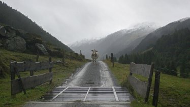
This hike to the top the Schafsiedel mountain is all about one element: water. Walkers can look forward to babbling brooks and three lakes. At 2,447 metres, the Schafsiedel is one of the highest mountains in the Kitzbühel Alps. The marvellous panorama from the top of the mountain takes in the Rosswildalm hut and the magnificent Hohe Tauern Mountains. The Neue Bamberger Hütte (currently not open) is just one of the several huts en route serving food and drink.

Summit Hike
Starting point
Gasthof Wegscheid, Kelchsau
Hike to
Schafsiedel (2,447 Metres)
Finishing point
Gasthof Wegscheid, Kelchsau
Mountain chain
Kitzbühel Alps
Length
15.2 km
Total hiking time
8 h 30 min
Features
- Wheelchair-accessible Hiking Route
- Circular hike
Difficulty rating
intermediate (red mountain trails)
Altitude
Elevation uphill 1,317m
Vertical metres downhill 1,317m
Fitness level
Technique
Best time of year
* These are approximate values and recommendations. Please take your personal fitness level, technical ability and the current weather conditions into account. Tirol Werbung cannot guarantee that the information provided is correct and accepts no liability.
Public transport
- Accessible using public transport
Bus route 4057, get off at stop Kelchsau Gh. Dorfwirt
Parking
Parking available at the Gasthof Wegscheid
Places serving food & drink
- Gasthof Wegscheid (open all year; closed on Tuesdays)
Downloads
Trail description
The approach is by car via the Zwieselbrücke bridge (toll booth) into a valley known as the Kurzer Grund. Park in the hikers' car park at Gasthof Wegscheid. The hike initially begins on a forest path, then changes to a narrow path that shortens the route through the forest and crosses streams several times.
Always follow the signs to the Neue Bamberger Hütte. After about an hour, the path rejoins the farm track and you soon reach the Neue Bamberger Hütte (currently not open). Behind the hut, follow the path across alpine meadows until a sign points the way to Schafsiedel. From there, continue along the signposted mountain path to Unterer Wildalmsee. A good 20 minutes later, you reach the second lake, the Mittlerer Wildalmsee. After a few terrain steps, you finally reach the Oberer Wildalmsee, which is located directly below the summit ridge. Now it is only a short climb to the summit of the Schafsiedel (2,447 metres).


