
Opening hours:Today closed
Place:Reith bei Seefeld
:Alpine pasture / hut / mountain restaurant
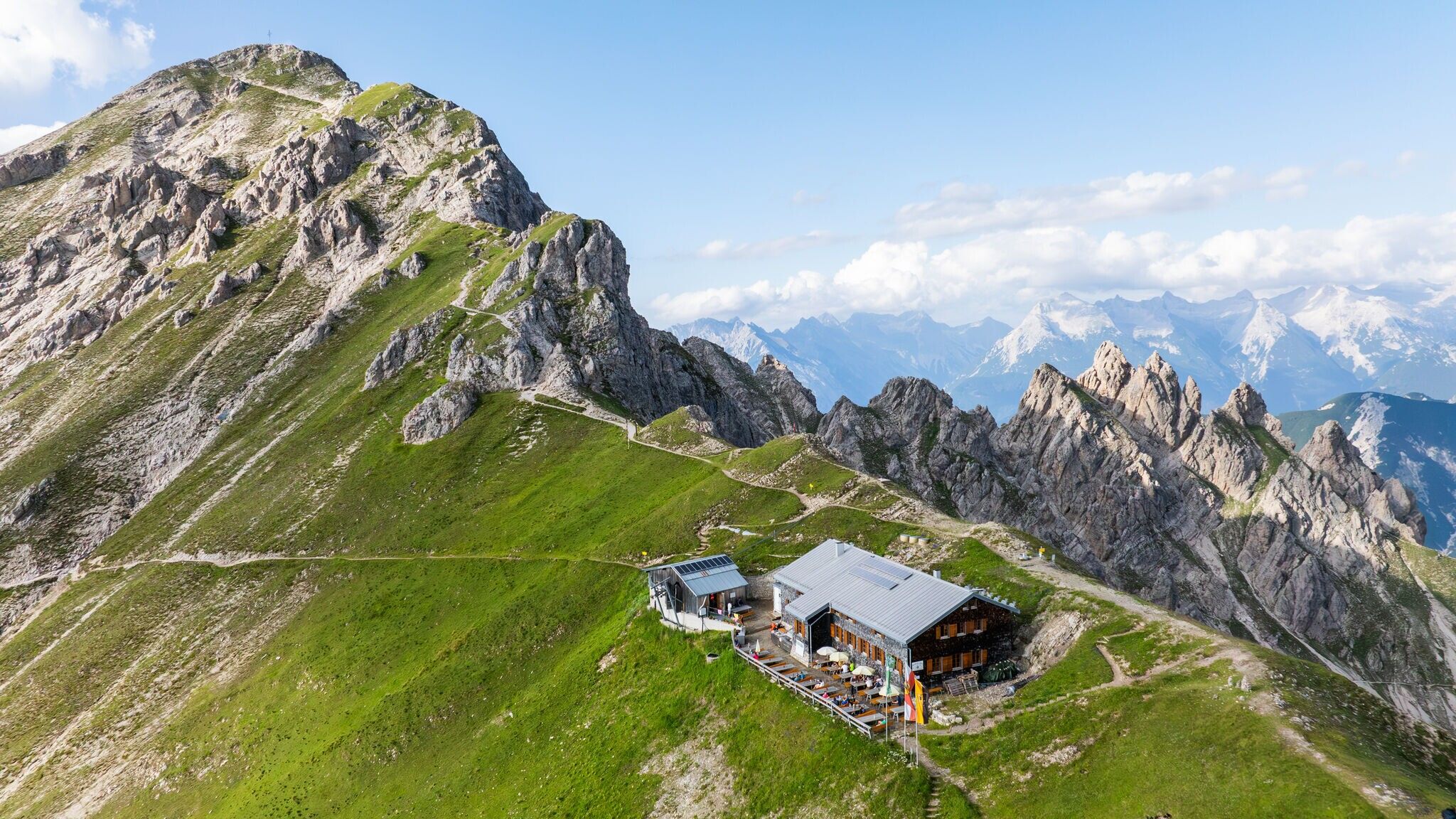
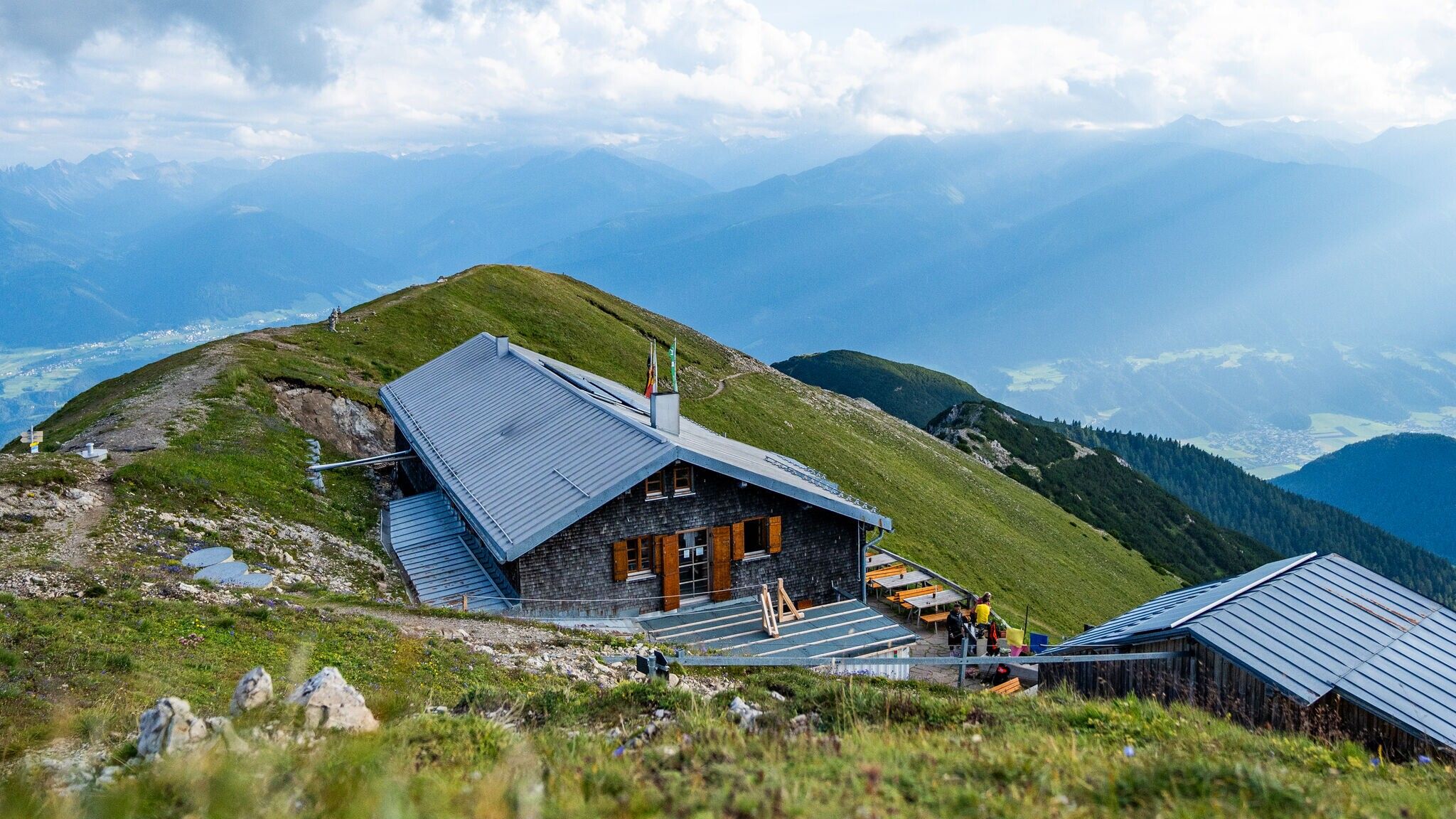
One of the most beautiful places for sunsets, we think - and you don't even have to go all the way to the summit. Even from the Nördlinger Hütte you have the best view to the west.
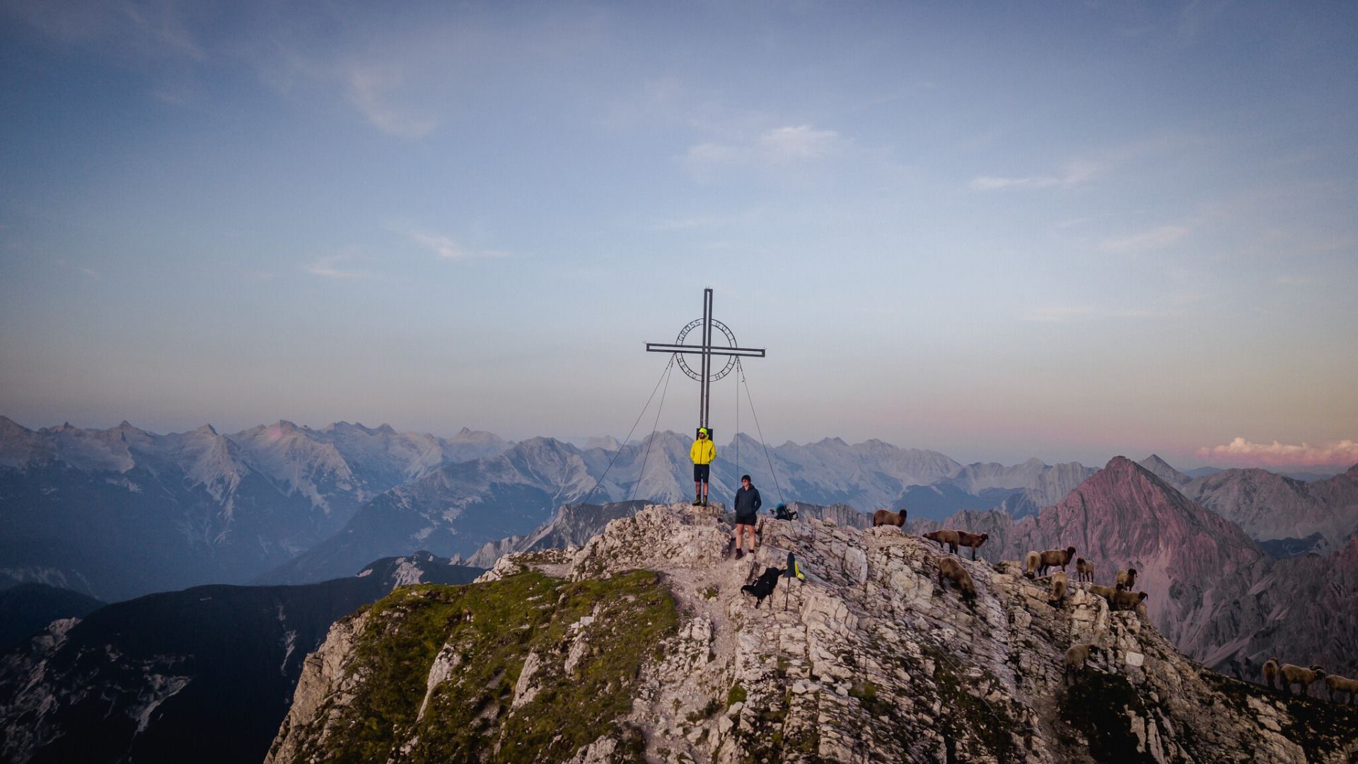
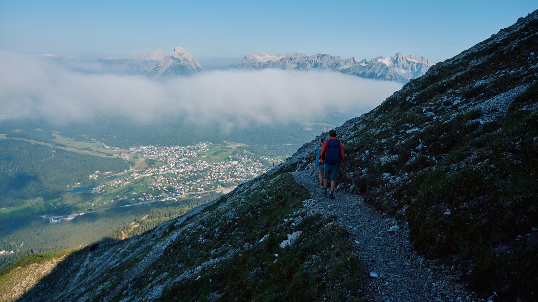
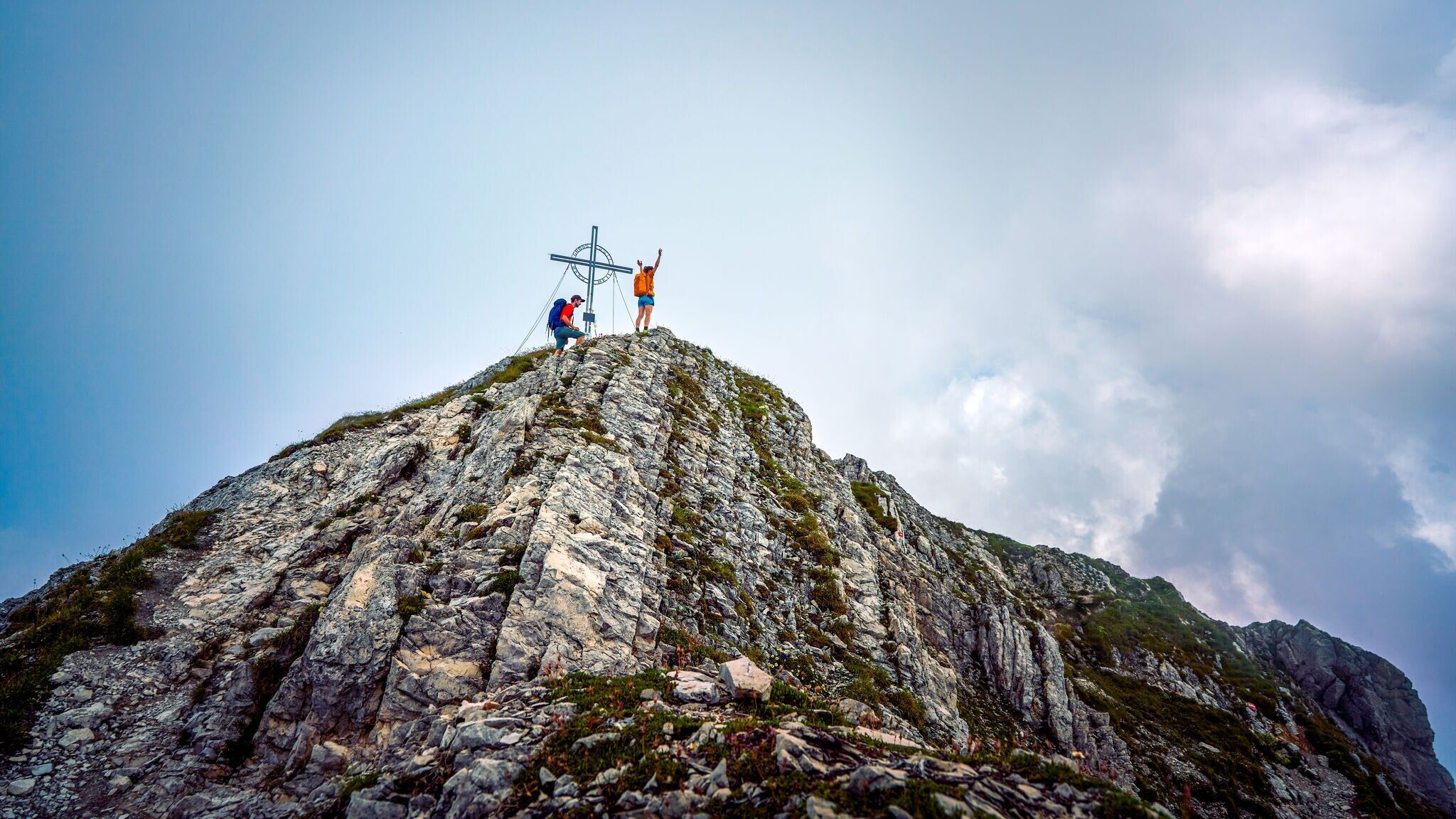
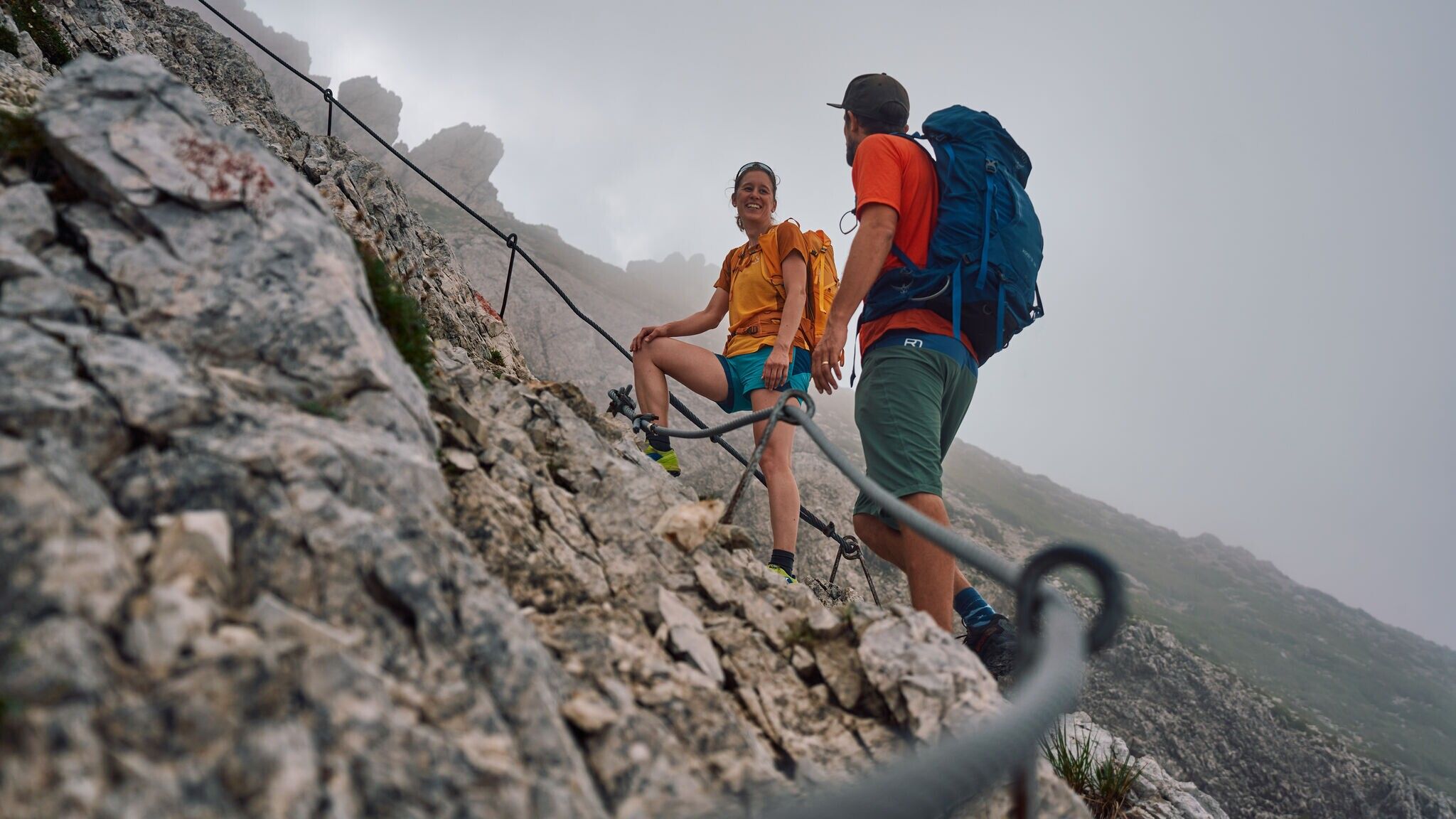
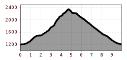
Medium-difficulty summit tour to the popular Reither Spitze with easy scrambling. The rather long ascent from Reith bei Seefeld via the closed Schartlehnerhaus and the Nördlinger Hütte requires fitness. However, it is away from the main routes from the mountain railroads in the north and is much less frequented. Ascent first through mountain pines, then through open terrain over the Schoaßgrat ridge. Behind the Nördlinger Hütte, a path leads to the rocky summit structure. There are a couple of insurance points for easy scrambling, surefootedness is advisable, otherwise not difficult. From the summit, the view is mainly to the west over the wide Seefeld plateau to the Zugspitzplatt, but also to the Karwendel and the glaciers of the Stubai Alps and the Großvenediger. Take care when crossing the main road - some cars drive very fast. Arrival and departure are possible with the S-Bahn and regional train from both Reith and Seefeld (free of charge with a valid guest card). In summer, Seefeld can also be reached by ICE train from Munich or Garmisch-Partenkirchen.
Forest path, meadow path, root trail, gravel path, and asphalt road.
All current information about the trail closures in the Region Seefeld can be found here.
Have you been out and about in the Region and discovered a spot that we should rework or repair? Fill out the form "Report a danger zone" and let us know where work is needed.
Sturdy hiking shoes, functional clothing, a backpack, water, snacks, alpine experience, and sure-footedness are necessary for this tour!
Also recommended: a hiking map or GPS, a first aid kit, sun protection, hiking poles, and an emergency blanket.
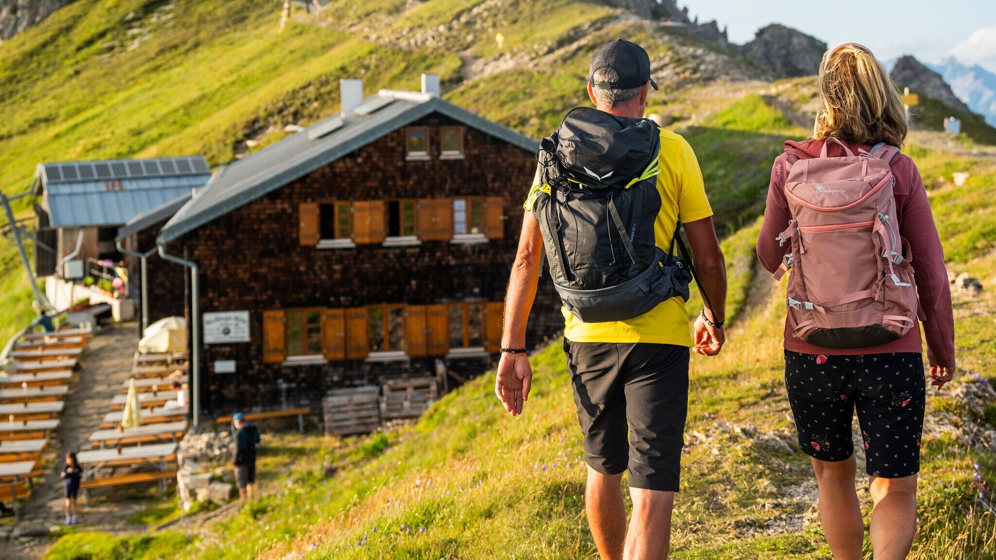
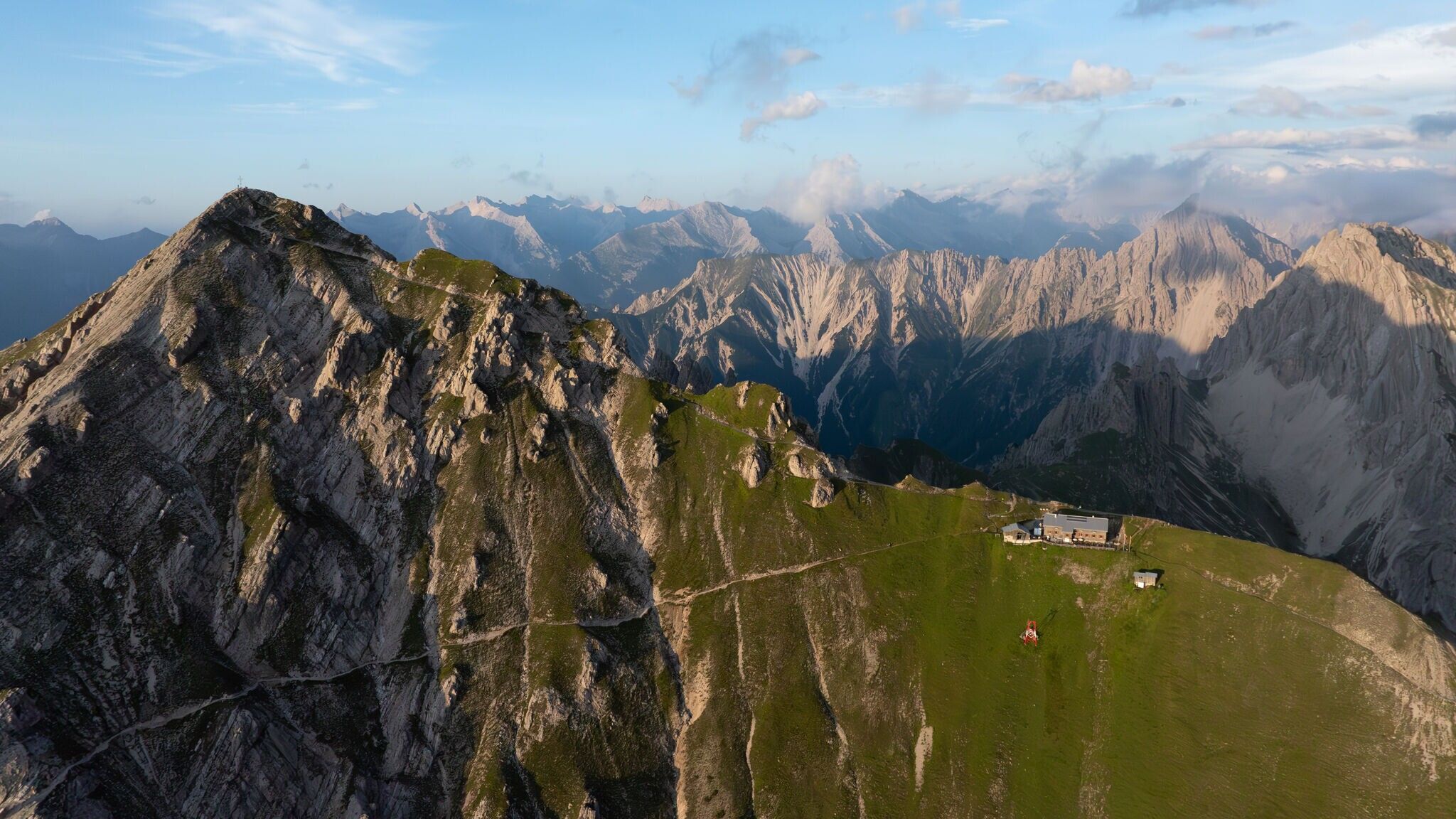
The starting point of this challenging tour is parking lot P6 near the Maxhütte. From there, you pass the Ichthyol factory and follow hiking trail No. 84 to the Reitherjochalm at 1,505 meters. The path initially follows a forest road until, after crossing the Mühlbach stream, trail No. 84 turns into a steeper footpath that leads through the forest. You pass under the cable lift that supplies the hut with food and quickly gain altitude on the winding trail. Finally, you reach the Nördlinger Hütte at 2,238 meters, the highest hut in the Karwendel range. From there, the trail continues along the "Reither Spitze Normal Route" to the Reither Spitze peak (2,374 meters). From the top, you can enjoy a beautiful view of the surrounding mountain ranges and a wide panorama across the entire plateau. This route is suited for experienced and sure-footed hikers.
For the descent, there are two options:
Take public transport to Seefeld train station, then it's a 20-minute walk to the starting point at parking lot P6 Maxhütte.
All real-time connections can be found in the route planner.


.jpg")

.jpg")


.jpg")
.jpg")

.jpg")
.jpg")


.jpg")
 Olympiaregion Seefeld")


.jpg")

 (2).jpg")


