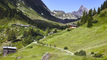
This charming trail into the higher regions of the north-eastern Silvretta Mountains initially leads through a mountain forest and to the picturesque huts of the "Äußern Bergli" at 2,080 metres above sea level. The many steep slopes en route require a good level of fitness. Hikers will need to be experienced and sure-footed to reach the summit of the Rauher Kopf (2,478 metres). A special reward is the panoramic view of the Paznaun Valley and the Verwall Mountains on the opposite side. The hike begins in Mathon (1,440 metres) and also ends there. Please be aware that there are no places serving food and drink along the route.

Summit Hike
Starting point
Mathon
Hike to
Rauher Kopf
Finishing point
Mathon
Mountain chain
Silvretta Alps
Length
9.2 km
Total hiking time
7h
Features
- Wheelchair-accessible Hiking Route
- Circular hike
Difficulty rating
intermediate (red mountain trails)
Altitude
Elevation uphill 1,100m
Vertical metres downhill 1,100m
Fitness level
Technique
Best time of year
* These are approximate values and recommendations. Please take your personal fitness level, technical ability and the current weather conditions into account. Tirol Werbung cannot guarantee that the information provided is correct and accepts no liability.
Public transport
- Accessible using public transport
Bus route 260, get off at stop Ischgl Mathon Ost
Parking
Parking on the outskirts of Mathon as well as by the bus stop on the Silvrettastraße road
Places serving food & drink
Wirtshaus Walserstube, Gasthof Glöckner and many other locations in Mathon. Please be aware that there are no huts on the hike serving food and drink.
Downloads
Trail description
From the bus stop at the chapel on the eastern outskirts of Mathon, the path leads eastwards to a farm track and over the Trisanna bridge. Follow the signs for the climb to the Rauher Kopf. The path begins steep and remains so. Keep your eyes open here for meadows, larch trees, birch trees and alder trees as well as blueberry trees. There are several good spots where you can take a break and enjoy the view. At an altitude of 1,720 metres, cross the wild Lahnerbach stream on a wooden footbridge. At 2,080 metres you will reach the quaint huts of the Außerbergler Taja (Äußeres Bergli) and with it the tree line. The vista here extends across the mountains to the peaks of the Bieler Höhe (2,037 metres). Don't let yourself get too distracted as the path here has some rocky and root-filled sections where careful footwork is required. Continue following the signpost to your destination - the path is well marked. It is relatively gentle at first, but after crossing the grassy slopes, it pitches up noticeably. At an altitude of 2,411 metres you reach a saddle and then continue along the broad ridge until you finally tackle the last section to the summit. From the small plateau around the summit cross (2,478 metres), the view opens up down into the Paznaun Valley, to the Fluchthörner peak and the Verwall Mountains.
Head back along the same route to the starting point in Mathon.


