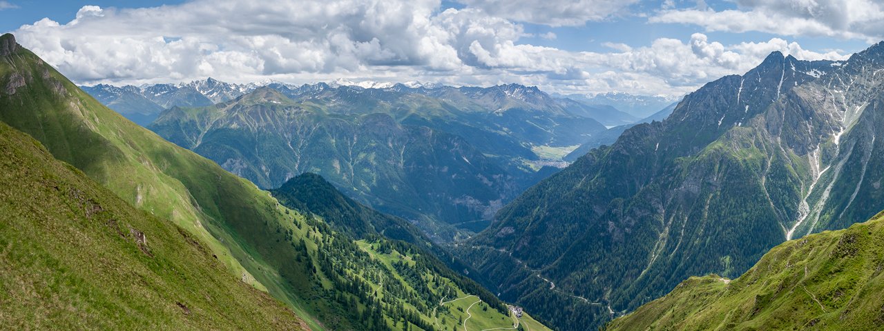
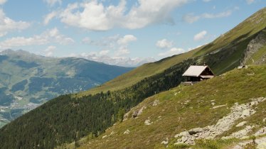
Hikers taking on this long circular trail in the southern Samnaun Mountains will pass four summits. Much of the walking is on ridges, meaning there are plenty of fantastic views on offer streching as far as Nauders and the Reschensee lake to the south as well as the Silvretta Mountains to the west. The adventure begins in the remote village of Spiss in the Samnauntal Valley, which at 1,650 metres above sea levei is the highest municipality in Austria. The first section leads up onto the Muttakopf mountain above the village before continuing on a grassy ridge to In der Keil, the Rotspitze and, finally, the Kreuzjoch mountain - at 2,698 metres the tallest peak of this hike. The ascents and descends of the mountains are steep but pose no major technical challenges. Hikers will need to be fit to enjoThere is a hut en route, the Kobler Alm. Otherwise you will need to take plenty of food and water with you. Water sources are few and far between.

Summit Hike
Starting point
Oberspiss (Mittelspiss 13)
Hike to
Muttakopf (2,525 metres), In der Keil (2,679 metres), Kreuzjoch (2,698 metres)
Finishing point
Oberspiss (Mittelspiss 13)
Mountain chain
Samnaun Mountains
Length
17.3 km
Total hiking time
8h
Features
- Wheelchair-accessible Hiking Route
- Circular hike
Difficulty rating
intermediate (red mountain trails)
Altitude
Elevation uphill 1,270m
Vertical metres downhill 1,270m
Fitness level
Technique
Best time of year
* These are approximate values and recommendations. Please take your personal fitness level, technical ability and the current weather conditions into account. Tirol Werbung cannot guarantee that the information provided is correct and accepts no liability.
Public transport
- Accessible using public transport
Bus stop: Spiss, Abzw. Dorf; bus route 212 (Pfunds – Spiss), further bus connections from Pfunds to Landeck or Nauders
Parking
Oberspiss (a few parking spaces available)
Places serving food & drink
- Kobler Alm
- Gasthof Alpenrose, Spiss
- Hotel-Restaurant Landhaus Paradies, Spiss
Downloads
Trail description
The hike begins in Oberspiss (post box). On the road which leads around the Haus Bergfeld building in a sharp bend, first walk eastwards. The paved road turns into a forest path, which leads up in several hairpin bends towards the Muttakopf. Shortly before the tree line at about 2,100 metres above the tree line, a path branches off to the left. Follow it. The terrain opens up. Crossing meadows, the path now climbs increasingly steeply. After about an hour (from the tree line) the first summit - the Muttakopf (2,525 metres) - is reached. From there, follow the ridge in northeastern direction. A path is not always visible here, but on the grass, which is kept short by sheep, it is usually very easy to find the way (be careful when it is wet). After a good half hour the next summit is reached: In der Keil (2,679 metres). After enjoying the panoramic view of Nauders, the Reschensee lake, the Samnaun Mountains and the Silvretta Mountains, continue hiking on the ridge that now leads to the southeast. After crossing the rather inconspicuous Rotspitze (2,672 metres) you soon reach the Kreuzjoch (2,698 metres), the highest peak of the hike. From there the descent to the south is on a steep winding path. A little below the tree line, you pass the Kobler Alm and then follow a forest path to the west. Below the Valatscherkopf the hamlet of Gstalden is passed, then the hike continues through the Gstaldner Tobel and back to Spiss on a narrow forest path.


