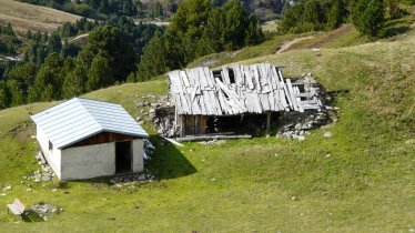
Around 350 years ago the Hochoetz region was used to mine copper pyrite, pyrite and galena at altitudes of up to 2,500 metres. The Mining Trail takes hikers to the most important spots, such as the reconstructed miners' house with a stamp mill and a small mining museum located in the remote Wörgltal Valley at 2,000 metres above sea level. Tour 1 of the Mining Trail is a circular hike of intermediate difficulty starting at the cable car in Hochoetz and leading via the Balbach Alm hut, the Wörgltal Valley, the summit of the Wetterkreuzkogel mountain (2,592 metres) and the Bielefelder Hütte hut back to the starting point. Most of the hike is above the treeline, so on sunny days it is important to remember to apply suncream. There are no difficult sections, though walkers must be sure-footed.


Themed Hike
Starting point
Top station of Acherkogelbahn cable car, Hochoetz
Finishing point
Top station of Acherkogelbahn cable car, Hochoetz
Mountain chain
Stubai Alps
Length
11.2 km
Total hiking time
6h
Features
- Wheelchair-accessible Hiking Route
- Circular hike
Difficulty rating
intermediate (red mountain trails)
Altitude
Elevation uphill 890m
Vertical metres downhill 890m
Fitness level
Technique
Best time of year
* These are approximate values and recommendations. Please take your personal fitness level, technical ability and the current weather conditions into account. Tirol Werbung cannot guarantee that the information provided is correct and accepts no liability.
Public transport
- Accessible using public transport
Bus route 4194, get off at stop Oetz Acherkogelbahn
Parking
Car park at the bottom of the Acherkogelbahn cable car in Oetz
Places serving food and drink
- Balbach Alm (early June until mid-October)
- Bielefelder Hütte (mid-June until mid-September)
- Panoramarestaurant Hochoetz
Downloads
Trail description
After travelling up onto the mountain with the Acherkogelbahn connecting Oetz and Hochoetz (2,020 metres), the Mining Trail (Tour 1) first leads along a wide road and a ski piste uphill in a north-easterly direction. Follow the signs for the Balbach Alm hut. Just before you reach the hut there is a downhill section, followed by some meadows and (first to the north, then to the east) a path around the Zwölferköpfl mountain. On the eastern side of the mountain is a trail which branches off sharp right into the Wörgltal Valley. After around 600 metres hikers will reach the reconstructed miners' house with a stamp mill like that used by miners many centuries ago. The small Puchersee lake is also nearby. The next section leads uphill, with the treeless terrain becoming increasingly steep, in a southerly direction as far as the summit of the Wetterkreuzkogel (2,592 metres). From here, follow the trail downhill in a northwesterly direction, skirting the summit of the Rosskopf mountain (2,399 metres) as far as the Bielefelder Hütte hut. After stopping off there for a well-deserved drink and snack it is just a few hundred metres back to the starting point at the bottom of the Acherkogelbahn cable car.
The route can also be hiked in the opposite direction.


