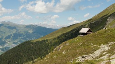
This circular walk in Nauders offers fabulous views of the surrounding landscape. Here, between the Reschen Pass and the Swiss border, lie the peaks of the Kleiner Mutzkopf and Großer Mutzkopf – and between them two beautiful mountain lakes: the Schwarzer See and the Grüner See. The hike begins with a chairlift ride up onto the Kleiner Mutzkopf mountain. From there, walkers pass several moors with white cotton grass before reaching the protected Schwarzer See. This lake is noted for its white waterlilies, which bloom every year in July. This moorland lake is the highest place anywhere in the Alps where such white waterlilies grow. After the loop around the lake, the hike continues to the Grüner See before returning back down to the bottom lift station.

Mountain Hike
Starting point
Top station of Mutzkopflift, Nauders
Hike to
Kleiner Mutzkopf, Schwarzer See, Grüner See
Finishing point
Top station of Mutzkopflift, Nauders
Mountain chain
Sesvenna Alps
Ötztal Alps
Length
10.3 km
Total hiking time
4h
Features
- Wheelchair-accessible Hiking Route
- Circular hike
Difficulty rating
easy (hiking trails)
Altitude
Elevation uphill 200m
Vertical metres downhill 500m
Fitness level
Technique
Best time of year
* These are approximate values and recommendations. Please take your personal fitness level, technical ability and the current weather conditions into account. Tirol Werbung cannot guarantee that the information provided is correct and accepts no liability.
Public transport
- Accessible using public transport
Bus route 273, get off at stop Nauders Mühle
Parking
Car park next to the Mutzkopf chairlift
Downloads
Trail description
The hike starts with a ride on the Mutzkopf chairlift. From the top of the chairlift take hiking trail number 9 to the Kleiner Mutzkopf and then on to the Schwarzer See lake, where hiking trail number 6 begins. One variation branches off at the eastern end of the lake and leads along the southern shore towards the Grüner See lake, while the other variation starts at the western end of the Schwarzer See lake. Both paths meet in the forest above the Schwarzer See. From there, walkers make their way through the spruce forest up to the Grüner See. Here, again, hikers have two options. They can continue to follow the path from the Grüner See in a south-easterly direction as far as a series of open meadows known as the "Großmutzwiesen". Alternatively, they can take trail number 6 in a north-easterly direction up onto the Großer Mutzkopf mountain, the highest peak in the area. From there they must follow hiking trail number 7 towards the Riatschwiesen meadows and the Riatschhof hut. Hikers who take trail 5a from Riatsch down to Nauders will find a signpost at the bottom of the Riatschwiesen meadows showing them the route along a former ski piste and through a forest down into the valley. Finally, hikers cross the main road and the bridge over the Stillebach river before passing the Gasthaus Martha and making their way back to Nauders.


