The highest peak in the Karwendel Mountains, the Birkkarspitze (2,749 metres), is the destination of this bike & hike. It is pre-destined for a combination of cycling and walking thanks to the long approach from Scharnitz. Even with the aid of two wheels, there are still more than 1,800 vertical metres of ascent from bottom to top. It is therefore only recommended for those with good fitness levels. After the long approach by bike through the Karwendeltal Valley there is time for a stop and a rest at the Karwendelhaus before things get steeper on the hike section. Towards the end of the hike there is even a bit of easy climbing and scrambling required. The reward for all that hard work is a fabulous panorama taking in not only the Hohe Tauern Mountains and the Ötztal Alps but also the alpine foothills over the German border in Bavaria.

Bike & Hike Adventure
Starting point
"Länd" car park, Scharnitz
Hike to
Birkkarspitze (2,749 metres)
Finishing point
"Länd" car park, Scharnitz
Mountain chain
Karwendel Mountains
Length
40 km
Features
- Wheelchair-accessible Hiking Route
- Circular hike
Difficulty rating
difficult (black trails)
Altitude
Elevation uphill 1,877m
Vertical metres downhill 1,877m
Best time of year
* These are approximate values and recommendations. Please take your personal fitness level, technical ability and the current weather conditions into account. Tirol Werbung cannot guarantee that the information provided is correct and accepts no liability.
Parking
"Länd" car park, Scharnitz
Places serving food & drink
- Karwendelhaus (early June until mid-October)
- Various locations in Scharnitz (at the start of the bike section)
E-bike recharging station
Karwendelhaus (please bring your own charging device)
Downloads
Trail description
Bike (intermediate)
Riding time: 3 h 30 min
Distance: 33.8 km
Vertical ascent: 905 vertical metres
Hike (difficult)
Hiking time: 5 h 30 min
Distance: 6.2 km
Vertical ascent: 972 vertical metres
The long ascent to the Birkkarspitze begins at the "Länd" car park in Scharnitz. Turn left and cross the Isar river, then turn right and shortly afterwards take the road on the left into the Karwendeltal Valley (Karwendelhaus, E4). The valley welcomes riders with a short but steep climb before flattening off for most of the remaining eight kilometres to the Larchetalm hut (no food & drink served). From the hut the trail becomes steeper in places, with a final series of steep corners leading up to the Karwendelhaus (1,771 metres). Stop there for a rest before embarking on the second and more difficult stage of the adventure: the hike.
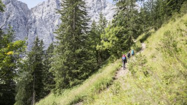
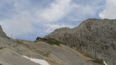
Behind the Karwendelhaus hut, take trail number 225 towards the Birkkarspitze mountain to the south-east. The steep path leads through a series of avalanche barriers, with a steel rope in sections for safety, then through larchwood forest and, after the turning to the "Brendelsteig" into the Schlauchkar and up onto the ridge. In early spring and late autumn there may be patches of snow here. After the steep and energy-sapping climb to the Schlauchkarsattel ridge, where hikers will find a small bivouac hut, the trail turns left for the final push to the top. There are a number of sections with a steel rope for safety. Hikers should be sure-footed and have a good head for heights. However, the fabulous views are a fine reward for all that hard work.
Return the way you came. Please be careful near the top of the Birkkarspitze due to the very steep slopes.


