This hike gives walkers the rare opportunity to follow one of the last free-flowing rivers in the Alps from start to finish. Measuring 76 kilometres in length, the East Tirol Isel Trail is a real adventure and invites hikers to take on five mainly easy stages on red (intermediate) trails. The only real tricky section comes towards the end, though these are made easier by the fact that there are steel ropes anchored into the rock for you to hold onto. The hike begins in the town of Lienz, where the Isel river flows into the Drau river, and leads up to the Main Alpine Ridge and on into the Virgental Valley. It is here that the river becomes smaller but wilder, with gorges, whitewater and waterfalls all featuring, including the famous Umbalfälle waterfalls on the edge of the Hohe Tauern National Park. The final highlight (in the truest sense of the word!) is a short section on the Umbalkees glacier, where the Isel river begins. The East Tirol Isel Trail can be easily accessed using the 960x bus Innsbruck or by train from Vienna. The buses within East Tirol can be used free of charge with the guest card.

Long-Distance Hike
Starting point
Lienz
Hike to
Umbalkees glacier
Finishing point
Ströden
Mountain chain
Venediger Mountains
Villgraten Mountains
Schober Mountains
Length
76.6 km
Duration
5 day(s)
Features
- Wheelchair-accessible Hiking Route
- Circular hike
Difficulty rating
intermediate (red mountain trails)
Altitude
Elevation uphill 2,229m
Vertical metres downhill 1,496m
Fitness level
Technique
Best time of year
* These are approximate values and recommendations. Please take your personal fitness level, technical ability and the current weather conditions into account. Tirol Werbung cannot guarantee that the information provided is correct and accepts no liability.
Public transport
- Accessible using public transport
- The railway station in Lienz is served by a wide range of bus and train connections (bus 960x from Innsbruck; RailJet train from Vienna)
- The journey back from Ströden/Hinterbichl to Lienz using bus route 951 is free of charge for holders of a guest card; get off at stop Bahnhof Lienz
Parking
Parking available at the railway station in Lienz
Places serving food & drink
- Stage 1: Landgasthof Bad Weiherburg, Ainet (overnight stays also possible)
- Stage 2: Café Landerl, Huben, Gasthaus Post, Huben, Landgasthof Steiner, Feld (detour), various locations in Matrei
- Stage 3: Restaurant Ortnerhof, Gasthof Schwaigerhof, Virgen, Schneiderhof, Prägraten (overnight stays also available), various locations in Prägraten
- Stage 4: Gasthof Islitzer, Hinterbichl (detour), Islitzeralm, Clarahütte
- Stage 5: Clarahütte, Islitzeralm
Downloads
Trail description
Stage 1: Lienz – Ainet – St. Johann im Walde
Uphill/downhill: 122/48 vertical metres, walking time: 4.25 hours, distance: 16.2 kilometres, highest point: 752 metres, difficulty rating: intermediate (red trails)
Stage one begins at the railway station in Lienz and leads along the banks of the Isel river through the town. After crossing over onto the western side of the river shortly before the Schloss Bruck castle ("Katzensteig" trail) you will find the first few islands, gravel banks and sandbanks. Continue up-river through a gorge and past the Daberer Wasserfall waterfall. The last part of stage one is again close to the Isel river, between Schlaiten and St. Johann im Walde, where the stage concludes.
Stage 2: St. Johann im Walde – Huben – Matrei in Osttirol
Uphill/downhill: 265/42 metres, walking time: 4.25 hours, distance: 15.5 kilometres, highest point: 975 metres, difficulty rating: intermediate (red trails)
On the second day, the trail begins by passing below a quarry. Then the route continues towards Huben. The Isel appears again with many long islands and a milky blue-green colour during the spring as a result of snow and ice meltwater flowing over and through mountan rock. After passing Huben, the valley becomes narrower and the river wilder. It now largely manages without protective dykes and instead flows in a wide, flat gravel bed. At Feld, the first cataracts and boulders in the river make for quite a background noise. The stage ends in Matrei, which lies in a wide valley basin and where there is plenty of accommodation available.
Stage 3: Matrei in Osttirol – Iselschlucht – Prägraten am Großvenediger
Uphill/downhill: 594/239 vertical metres, walking time: 5 hours, distance: 16.4 kilometres, highest point: 1,316 metres, difficulty rating: intermediate (red trails)
Stage three heads from Matrei west into the Virgental Valley, following the Isel river as it becomes more tubulent and wild. To the south of the river, on the shady side of the valley, the route leads mostly through forests. Just below the mountain village of Virgen the Isel thunders into a gorge over a mini waterfall known as the Virgener Katarakt. Just a few more kilometres further upstream, between Welzelach and Bobojach, you will enter another gorge known as the Iselschlucht. Further upstream the river becomes a little less wild once again as you approach the final destination of stage three in Prägraten, where there are plenty of accommodation options. If you have the time we recommend a small detour to the Zopatnitzen-Wasserfall waterfall.
Stage 4: Prägraten am Großvenediger – Islitzeralm – Clarahütte
Uphill/downhill: 800/86 vertical metres, walking time: 4.25 hours, distance: 12 kilometres, highest point: 2,038 metres, difficulty rating: intermediate (red trails)
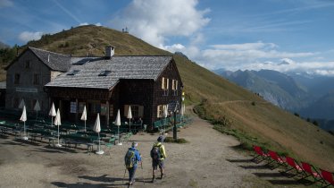
Stage four invites hikers to see the Isel river from its wild side. The stage begins with a relatively easy section along the quiet waters of the Isel. Near Ströden things get more spectacular as hikers reach a rocky outcrop from which they can see into the Glo-Schlucht gorge. The next highlights are the Strödener Wasserfall and, after passing the Islitzeralm hut, the mighty Obere Umbalfälle and Untere Umbalfälle waterfalls. There are even special viewing platforms at the latter to give visitors the chance to experience the incredible power of the water up close. From here, the route leads along an educational trail all about water into the Hohe Tauern National Park. After a while you will reach the Clarahütte (please make sure to call ahead if you plan on spending the night at the hut).
Stage 5: Clarahütte – Gletscherzunge am Umbalkees – Ströden
Uphill/downhill: 543/1,174 metres, walking time: 6 hours, distance: 16.5 kilometres, highest point: 2,499 metres, difficulty rating: intermediate (red trails)
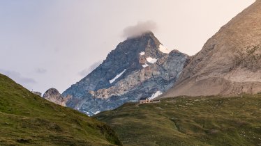
The fifth and final stage leads up, up, up into the alpine wilderness. It starts by heading in a northerly direction through lush pastures and over a ridge covered until relatively recently by the eternal ice of the Umbalkees glacier. The glacier has retreated dramatically in recent decades, so you will have to continue on to over 2,500 metres above sea level to reach its edge and with it the source of the Isel river. High above lies the 3,500-metre peak of the Dreiherrenspitze. The long hike down back to the car park in Ströden leads along the same way you came. From there you can take the bus number 951 back to Lienz. Use of the bus is free of charge for holders of a guest card.


