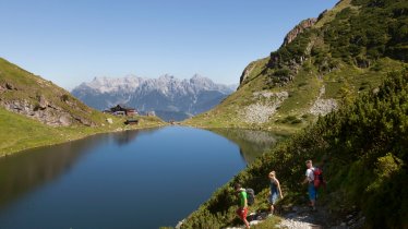
This hike of intermediate difficulty leads from the edge of Hochfilzen up onto the Buchensteinwand mountain (1,462 metres), the most beautiful vantage point in the Pillerseetal Valley. At the top of the mountain there is a huge crucifix measuring 30 metres in height and hollow inside, allowing visitors to climb up and enjoy the 360° view. En route lies the Hoametzl-Hütte, a charming alpine hut at 1,200 metres offering wonderful vistas of the Loferer and Leogang Rocky Mountains. The hut serves hearty local food and has a large play area for children. Next to the cross at the top of the mountain there is the Alpengasthof Buchensteinwand, another hut known for its strudels, dumplings and ice-cream creations.

Mountain Hike
Starting point
Bottom of draglift in Oberwarming
Hike to
Buchensteinwand mountain
Finishing point
Bottom of draglift in Oberwarming
Mountain chain
Loferer Rocky Mountains
Length
6.6 km
Total hiking time
3 h 27 min
Features
- Wheelchair-accessible Hiking Route
- Circular hike
Difficulty rating
intermediate (red mountain trails)
Altitude
Elevation uphill 580m
Vertical metres downhill 580m
Fitness level
Technique
Best time of year
* These are approximate values and recommendations. Please take your personal fitness level, technical ability and the current weather conditions into account. Tirol Werbung cannot guarantee that the information provided is correct and accepts no liability.
Public transport
- Accessible using public transport
Bus route 8302, get off at stop Hochfilzen Gemeindeamt
Parking
Bottom of draglift in Oberwarming
Places serving food and drink
- Hoametzl-Hütte (open Saturdays, Sundays and bank holidays from late June until the middle of October)
- Alpengasthof Buchensteinwand (open from May until October)
Downloads
Trail description
The hike begins at the draglift in Oberwarming, a settlement forming part of Hochfilzen. Take the Tennweg road heading south and branch off to the right before continuing for a while to a farmstead called Untertenn. From there, either take the steep path at the signpost heading up through the forest and across the meadows, or take the "Kammbergweg" trail to the Hoametzl-Hütte. From the hut, keep walking uphill following the route of the Hochfilzen II lift, past the reservoir all the way to the top of the Buchensteinwand (1,462 metres) with its 30-metre-high cross at the summit and the Berggasthof Buchensteinwand nearby serving food and drink.


