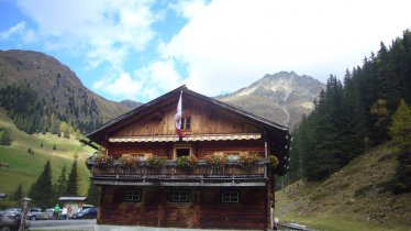
Water in all its many fascinating forms accompanies hikers on this themed hiking trail near the entrance to the Virgental Valley in East Tirol. Starting from Hinterbichl, the Umbalfälle Water Hiking Trail leads along the banks of the rushing Isel river up into the steep-sided Umbaltal Valley. The Isel river itself is fed by the Umbalkees glacier on the western edge of the Großvenediger Massif and is one of the most important watercourses in East Tirol. Among the many highlights is the section next to the Islitzer Alm hut, where the water rushes over a series of steps and throws up a fine, cooling spray. Along the way there are several viewing platforms. In the 1920s the members of the famous Vienna Boys Choir would come here each summer to enjoy the clean air – thereby laying the foundations for tourism in Hinterbichl. This hike is suitable for children aged six years and above. Please be aware that the paths can be slippery around the waterfalls.

Themed Hike
Starting point
Hinterbichl
Hike to
Umbalfälle waterfalls
Finishing point
Hinterbichl
Mountain chain
Venediger Mountains
Length
5.9 km
Total hiking time
2 h 30 min
Features
- Wheelchair-accessible Hiking Route
- Circular hike
Difficulty rating
intermediate (red mountain trails)
Altitude
Elevation uphill 277m
Vertical metres downhill 277m
Fitness level
Technique
Best time of year
* These are approximate values and recommendations. Please take your personal fitness level, technical ability and the current weather conditions into account. Tirol Werbung cannot guarantee that the information provided is correct and accepts no liability.
Public transport
- Accessible using public transport
Parking
Car park at the bridge near the Gasthof Islitzer
Huts serving food and drink
- Islitzer Alm (open all year)
- Pebell Alm (late May until late September)
- Gasthof Islitzer
Downloads
Trail description
In Hinterbichl, cross the bridge at the bus stop leading to the campsite. Behind the campsite, cross the Isel river towards "Wasserschaupfad Umbalfälle". Once at the transformer station, continue into the valley and follow the wide path towards “Ströden”. Proceed into the valley along the banks of the Isel river. Continue on a forest trail that eventually becomes noticeably steeper. At Ströden, cross the Isel river once again towards the forest road that provides a leisurely route to the Islitzer Alm and to the nearby Pebell Alm huts. After the pastures, walk on the right bank of the Isel river along the "Wasserschaupfad Umbalfälle" until the last marker, numbered 14. From there, head back the same way a few metres but branch off right shortly afterwards towards “Aussichtskanzel Großbach” lookout point. Take the winding forest road downwards until it joins the original route and head back to the bus station in Hinterbichl.
Tip! Those who wish to shorten the hike can drive to the car park in Ströden (pay-and-display) and start walking from there.


