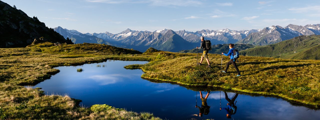
Taking 13 hours, this circular hike in the Tux Alps leads from Hochfügen to the Rastkogel mountain (2,762 metres) through wonderful meadowland home to a number of small lakes and a wide range of fauna and flora. The pyramid-shaped Rastkogel mountain offers fantastic views of the surrounding region, including the majestic glaciers on the Tux Alps Main Ridge as well as the Stubai Alps and the Karwendel Mountains. The Rastkogelhütte (2,124 metres), which hikers pass on the way back to the starting point, is a good place to stay the night and turn this walk into a two-day adventure. Fit hikers will be able to complete the entire route in just one day. Take the bus from the village of Uderns to Hochfügen, the start and finish point of this 24.5km circular hike.

Mountain Hike
Starting point
Hochfügen
Hike to
Rastkogelhütte
Finishing point
Hochfügen
Mountain chain
Tux Alps
Length
24.5 km
Total hiking time
13 h 30 min
Features
- Wheelchair-accessible Hiking Route
- Circular hike
Difficulty rating
intermediate (red mountain trails)
Altitude
Elevation uphill 1,972m
Vertical metres downhill 1,972m
Fitness level
Technique
Best time of year
* These are approximate values and recommendations. Please take your personal fitness level, technical ability and the current weather conditions into account. Tirol Werbung cannot guarantee that the information provided is correct and accepts no liability.
Public transport
- Accessible using public transport
Parking
Railway station in Uderns
Places serving food & drink
- Rastkogelhütte (June until October)
- Berghotel Hochfügen, Hotel Almhof, Hotel Lamark and other locations in Hochfügen
Downloads
Trail description
From Hochfügen (elev. 1,470m), take the gravel road that runs past Pfundsalm Alpine Pasture Hut (elev. 1,640m) and continues atop Sidanjoch Col. From the 2,127-meter col you can either walk over to Rastkogel Hut (elev. 2,124m) or follow Zentralalpenweg Trail to sparkling Sidanseen Lakes and on to gain the summit of 2,762-meter Rastkogel Peak. Walk back along Viertelalm Hochleger and Niederleger to Holzalm Alpine Pasture Hut with the trail bringing you back down to Hochfügen. This demanding tour will cost you nearly 1,400 vertical meters of sweat and toil.
Take the bus from Uderns (549 metres) to Hochfügen (1,474 metres). The journey takes 45 minutes. From Hochfügen, follow the gravel trail – along the banks of the Finsingbach stream – uphill to around 1,600 metres above sea level, past the Pfundsalm-Niederleger building, then the Pfundsalm-Mittelleger (1,832 metres) and, after crossing over the stream, up via a series of switchbacks to the Sidanjoch ridge (2,127 metres). From the ridge, head either straight to the Rastkogelhütte (2,124 metres) or via the Central Alpine Way to the Sidanseen lakes and then on to the Rastkogel mountain. Then, take the same way back to the ridge before heading east to the Rastkogelhütte. After a break at the hut (or an overnight stay) head down in a northerly direction to the Viertelalm-Hochleger and via a series of switchbacks to the Viertelalm-Niederleger. The final section takes in the Holzalm-Niederleger before reaching the village of Hochfügen, where a bus will take you back to Uderns.


