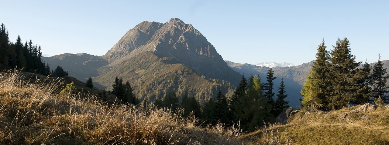
It is known as the "King of the Kizbühel Alps", even though it is not actually the highest peak in the range: the Großer Rettenstein (2,366 metres). It is, however, truly majestic with its rocky peak and fabulous views from the top. Those who want to enjoy the view for themselves can embark on a bike & hike adventure. The bike section leads through the Unterer Grund and a shady forest to the Schöntalalm hut. From there, swap the biking shoes for the hiking boots for the final push up onto the summit of the Großer Rettenstein. The last section contains a bit of easy climbing.

Bike & Hike Adventure
Starting point
Ebenau car park, Aschau
Hike to
Großer Rettenstein (2,366 metres)
Finishing point
Ebenau car park, Aschau
Mountain chain
Kitzbühel Alps
Length
20.4 km
Features
- Wheelchair-accessible Hiking Route
- Circular hike
Difficulty rating
intermediate (red mountain trails)
Altitude
Elevation uphill 1,331m
Vertical metres downhill 1,331m
Best time of year
* These are approximate values and recommendations. Please take your personal fitness level, technical ability and the current weather conditions into account. Tirol Werbung cannot guarantee that the information provided is correct and accepts no liability.
Public transport
- Accessible using public transport
Parking
Ebenau car park, around 600 metres south of the Oberlandhütte hut (free of charge)
Places serving food & drink
- Schaukäserei Kasplatzl (homemade dairy products sold; open mid-May until early October)
- Berggasthof Labalm (slightly off the main trail; open mid-May until October)
E-bike charging stations
- Schaukäserei Kasplatzl
- Berggasthof Labalm
Downloads
Trail description
Bike (intermediate)
Riding time: 2 h 20 min
Distance: 14.9 km
Vertical ascent: 580 vertical metres
Hike (intermediate)
Hiking time: 4 h 30 min
Distance: 5.4 km
Vertical ascent: 751 vertical metres
This adventure begins at the car park in Ebenau at the Unterer Grund south of Aschau. Riders take route 204 up to the Hintere Schöntalalm. From the toll booth, the gradient is relatively gentle as the trail heads into the valley. Ignore the path near the start leading via the Sonnwendalm hut to the Schöntalalm hut and instead stay on the main dirt road. At the Karalm hut (1,323 metres) take the trail named "Rettensteinweg" (number 14), which swings around almost 180° to the left / north-east and heads into the forest and uphill. The gradient eases and then, below the Spießnägel (1,880 metres), after a short descent and southward turn, things get steeper again. Continue towards the Hintere Schöntalalm hut (1,601 metres). It is here that the bike ride ends and the hike begins.
Take the trail (21; 715) gently uphill through open meadows into the valley, towards the Rettenstein mountain on the right-hand side. You will soon reach a series of buildings known as the "Schöntalscherm-Hütten". The narrow trail becomes steeper, passes a spring, heads through grassy slopes and then becomes increasingly rocky. Towards the summit the trail becomes very steep, rocky and challenging, especially before reaching the Rettensteinscharte ridge. Some sections here require easy climbing and scrambling. At the top of the Großer Rettenstein (2,366 metres) there are fantastic views of the surrounding landscape, including the glaciers of the Großvenediger mountain to the south.
Return along the same route.


