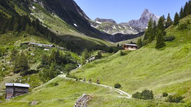
Bikers and hikers can look forward to sensational views of the Alps from the 3,196-metre-high Dreiländerspitze mountain. It starts in Galtür and leads into the Jamtal Valley to the Jamtalhütte hut. Leave the bike there and continue on foot, including a section across the Jamtalferner glacier, along black (difficult) hiking trails. The final push up to the top of the Dreiländerspitze is tough and requires not only excellent fitness but also experience of hiking in alpine terrain. The trickest section is the last one just before you get to the summit.

Bike & Hike Adventure
Starting point
Galtür
Hike to
Jamtalhütte, Dreiländerspitze
Finishing point
Galtür
Mountain chain
Silvretta Alps
Length
32 km
Features
- Wheelchair-accessible Hiking Route
- Circular hike
Difficulty rating
difficult (black trails)
Altitude
Elevation uphill 1,665m
Vertical metres downhill 1,665m
Best time of year
* These are approximate values and recommendations. Please take your personal fitness level, technical ability and the current weather conditions into account. Tirol Werbung cannot guarantee that the information provided is correct and accepts no liability.
Public transport
- Accessible using public transport
Parking
Pay-and-display car park next to the leisure centre ("Freizeitzentrum")
Places serving food & drink
- Menta-Alm (early June until early October)
- Scheiben-Alm (mid-June until late September)
- Jamtalhütte (mid-February until early May; early July until late September)
E-bikes can be hired from Intersport Wolfart
Downloads
Trail description
Bike (intermediate)
Riding time: 2 h 45 min
Distance: 20.1 km
Vertical ascent: 590 vertical metres
Hike (difficult)
Walking time: 7 h 10 min
Distance: 11.9 km
Vertical ascent: 1,075 metres
The adventure begins on the bike with a ride from the village of Galtür along mountain bike route 700 into the Jamtal Valley, heading south gently uphill. The stretch to the Jamtalhütte is quite long at 10 kilometres, but the trail is very good and – if needed – there is the option of stopping at the Menta-Alm hut or the Scheiben-Alm hut for a drink and a snack. Both huts serve homemade cheese. After around two hours of riding, including a steeper section at the end, you will reach the Jamtalhütte hut at 2,165 metres above sea level. Its large terrace offers magnificent views of the Silvretta Mountains, including the Dreiländerspitze to the south-west.
After a rest at the hut it is time to pull on your hiking boots and make sure you have glacier equipment in your rucksack before setting off for the 3,196-metre peak of the Dreiländerspitze, located on the border with the Swiss Engadin. From the hut there is a good trail leading south. Follow this as far as a fork in the trail to the north of the Rußkopf mountain. Take the right-hand fork towards the Jammtalferner mountain. Follow the glacier stream to the left-hand side of the glacier tongue. It is here that the first steep section begins, followed by two more on the right-hand side of the glacier. Slightly further up there is a section with crevasses. Hikers then reach the Obere Ochsenscharte (2,970 metres). Turn south and continue through a steep snowfield to the western ridge of the Dreiländerspitze mountain. The final section is a scramble to the top, where fabulous views await. The last few metres are very exposed and require ropes.
Descend along the same route.


