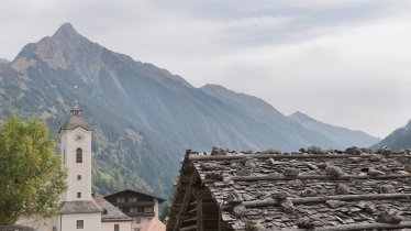
A sparkling mountain lake, majestic alpine views and a traditional hut serving hearty local food – this hike in the heart of the Zillertal Alps has everything that makes walking in Tirol such an enjoyable experience. The Furtschaglhaus (2,295 metres) is the destination on this mountain hike of intermediate difficulty which begins at 1,790 metres above sea level at the Jausenstation Zamsgatterl, which can be easily reached by car. The first section is nice and easy, along the shores of the lake, before things get steeper as the path winds its way up to the Furtschaglhaus. Despite this more challenging final section, the hike is suitable for children.

Mountain Hike
Starting point
Zamsgatterl near Schlegeis reservoir
Hike to
Furtschaglhaus
Finishing point
Zamsgatterl near Schlegeis reservoir
Mountain chain
Zillertal Alps
Length
14.2 km
Total hiking time
5h
Features
- Wheelchair-accessible Hiking Route
- Circular hike
Difficulty rating
intermediate (red mountain trails)
Altitude
Elevation uphill 544m
Vertical metres downhill 544m
Fitness level
Technique
Best time of year
* These are approximate values and recommendations. Please take your personal fitness level, technical ability and the current weather conditions into account. Tirol Werbung cannot guarantee that the information provided is correct and accepts no liability.
Public transport
- Accessible using public transport
Bus route 4102, get off at stop Schlegeis Stausee
Parking
"Zamsgatterl" car park, Schlegeis reservoir
Places serving food and drink
- Furtschaglhaus (June until September)
- Zamsgatterl (June until September)
Downloads
Trail description
lLeaving from the Zamsgatterl car park next to the Schlegeis reservoir (1,782 metres) to the south of the village of Ginzling, take a wide trail on the south-western shore of the reservoir for around four kilometres, heading into the valley. Cross over the stream which feeds the reservoir and continue along the trail for a while through an area of land known as the Furtschaglboden. Shortly before you reach a small cable car used to deliver food and supplies to the hut, the route leads uphill. It is here that the ascent to the Furtschaglhaus begins. The trail is well-maintained and not too steep thanks to many switchback corners. Don't forget to stop every now and then to enjoy the fantastic views of the Zillertal Alps, including the glacier-capped peak of the Schönbichler Horn (3,134 metres), the eye-catching Furtschaglspitze (3,190 metres) and the Großer Möseler (3,478 metres). After around two and a half hours you will reach the Furtschaglhaus. Return along the way you came.
There is also the option of descending via the Schönbichler Horn (3,134 metres), but this route is only recommended for experienced mountaineers.


