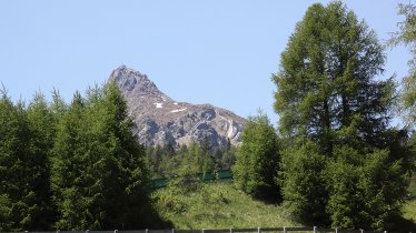
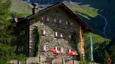
Hikers cross almost the entire Lienz Dolomites on this five-day walk, most of which leads through challenging terrain requiring sure footing. Numerous ridges and peaks, including the Große Sandspitze (2,770 metres), the highest mountain in the Lienz Dolomites, lie along the way and offer fantastic views in all directions. Sure-footedness and experience of hiking in the mountains are prerequisites for this hike. If you want to tackle the difficult via ferrata on stage 3 you will also need a special via ferrata safety kit. Inexperienced hikers can simply skip this stage. Another highlight is the freezing cold Laserzsee lake near the Karlsbader Hütte - a challenge for brave swimmers and a great spot for a memorable Insta photo.

Starting point
Pirkach near Oberdrauburg
Hike to
Kerschbaumer Alm, Karlsbader Hütte, Hochstadelhaus
Finishing point
Dolomitenhütte
Mountain chain
Gailtal Alps
Lienzer Dolomiten
Length
30.1 km
Duration
5 day(s)
Features
- Wheelchair-accessible Hiking Route
- Circular hike
Difficulty rating
difficult (black trails)
Altitude
Elevation uphill 3,366m
Vertical metres downhill 3,819m
Fitness level
Technique
Best time of year
* These are approximate values and recommendations. Please take your personal fitness level, technical ability and the current weather conditions into account. Tirol Werbung cannot guarantee that the information provided is correct and accepts no liability.
Public transport
- Accessible using public transport
Bus route 962, get off at stop Leisach Gries
Parking
Klammbrückl car park (above the Galitzenklamm gorge)
Places serving food & drink
- Kerschbaumeralm-Schutzhaus (open mid-June until mid-September)
- Karlsbader Hütte (open mid-June until mid-September)
- Hochstadelhaus (open mid-June until mid-September)
Downloads
Trail description
Stage 1: Klammbrückl car park - Kerschbaumer Alm
Vertical metres uphill/downhill: 1,310/500 vertical metres, walking time: 6 hours 20 minutes, distance: 7.9 kilometres, highest point: 2,399 metres, difficulty rating: intermediate (red trails)
The starting point is the Klammbrückl car park (1,092 metres) above the Galitzenklamm gorge. Hiker who wish to travel without their own car can take a taxi (operated by the Bundschuh taxi company) from the railway station in Lienz to Klammbrückl. This service operates in the mornings between the beginning of July and the beginning of September (Tel. +43 50 212 400). From the car park, head south along trail number 10. You will soon reach the Hallebachtal Valley branching off to the right. Climb up to the Hallebachtörl (2,399 metres), then descend in an easterly direction to the Kerschbaumer-Alm-Schutzhaus (1,902 metres). If you want to save time and make things a little easier, you can leave out the Hallebachtal Valley and take the direct route to the hut.
Stage 2: Kerschbaumer Alm - Karlsbader Hütte
Vertical metres uphill/downhill: 490/125 metres, walking time: 2 hours 20 minutes, distance: 3.8 kilometres, highest point: 2,285 metres, difficulty rating: intermediate (red trails)
From the Kerschbaumer Alm, head east along the Carinthian Border Trail to the Kerschbaumer Törl (2,285 metres). From there, it's not far to the next destination, the Karlsbader Hütte (2,260 metres), which is located just above the Laserzsee lake.
Stage 3: Karlsbader Hütte - Große Sandspitze - Karlsbader Hütte
Vertical metres uphill/downhill: 613/613 vertical metres, walking time: 3 hours 45 minutes, distance: 4.3 kilometres, highest point: 2,770 metres, difficulty rating: difficult (black trails)
Stage three is entirely dedicated to the panoramic via ferrata (a climbing route with iron handholds and footholds as well as a steel rope anchored into the rock for extra safety) and the highest peak in the Lienz Dolomites, the Große Sandspitze (2,770 metres). It leads in a loop back to the Karlsbader Hütte and can therefore easily be left out if you do not have the reuiqite climbing experience. The via ferrata (grade D, difficult) requires skill and a via ferrata safety set, but it rewards adventurers with sensational views and six peaks including the Grosse Sandspitze.
Stage 4: Karlsbader Hütte - Hochstadel - Hochstadelhaus
Vertical metres uphill/downhill: 953/1,434 vertical metres, walking time: 7 hours 15 minutes, distance: 9.9 kilometres, highest point: 2,681 metres, difficulty rating: difficult (black trails)
Stage four is the longest stage. It leads east along the Dreitörlweg via the Laserztörl (2,497 metres), the Kuhleitentörl (2,295 metres) and the Baumgartentörl (2,347 metres) to the highest peak of the stage, the Hochstadel (2,681 metres). From there you descend to the Hochstadelhaus (1,780 metres), the last place to spend the night in the mountains before stage 5 heads back down into the valley.
Stage 5: Hochstadelhaus - Bahnhof Nikolsdorf
Vertical metres downhill: 1,146 vertical metres, walking time: 2 hours 50 minutes, distance: 4.8 kilometres, highest point: 1,780 metres, difficulty rating: intermediate (red trails)
The Zabarot-Leitersteig trail (ÖTK trail number 217) takes you down to the railway station in Nikolsdorf im Drautal. This descent is a challenging one with many wooden ladders. Surefootedness is an absolute must here.
From the railway station in Nikolsdorf take the train back to the starting point in Lienz.


