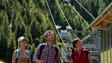
This idyllic hike suitable for families with children leads through pastures and meadows near Galtür and Ischgl before winding its way up through flower-filled fields along a rushing river to the charming Friedrichshafener Hütte at 2,100 metres above sea level. This hut is known for its excellent food as well as its magnificent views of the Verwall Mountains and the many 3,000-metre peaks in the Silvretta Mountains. Last but not least, there is a beautiful mountain lake where brave hikers can take a refreshing dip on hot days.

Mountain Hike
Starting point
Mathon, bus stop on the Silvrettastraße road
Hike to
Friedrichshafener Hütte
Finishing point
Mathon, bus stop on the Silvrettastraße road
Mountain chain
Verwall Mountains
Length
6.9 km
Total hiking time
4 h 30 min
Features
- Wheelchair-accessible Hiking Route
- Circular hike
Difficulty rating
intermediate (red mountain trails)
Altitude
Elevation uphill 686m
Vertical metres downhill 686m
Fitness level
Technique
Best time of year
* These are approximate values and recommendations. Please take your personal fitness level, technical ability and the current weather conditions into account. Tirol Werbung cannot guarantee that the information provided is correct and accepts no liability.
Public transport
- Accessible using public transport
Bus route 260, get off at stop Mathon West
Parking
Large car park in Mathon on the Silvrettastraße road
Places serving food & drink
- Friedrichshafener Hütte (open mid-June until late September)
- Wirtshaus Walserstube
- Gasthof Glöckner und and many other locations in Mathon
Downloads
Trail description
The hike begins in the tiny village of Mathon at an altitude of 1,454 metres. From there, the route heads into the valley towards Valzur. The small road crosses the Fallbach and Valzurbach streams. After the Valzurbach bridge, a footpath branches off to the right in the direction of the "Friedrichshafener Hütte". Here it is worth looking back over the meadow slopes down to the tranquil village. After a short stretch through coniferous forest, the path joins a wider footpath that leads up from Galtür. The route now continues uphill on this path, often crossing the access road to the hut. If these shortcuts are too steep for you, stay on the access road. After exiting the tree line at around 1,900 metres above sea level, the view opens up even further and the trail leads through pastureland, alpine flower meadows and over alpine rose slopes. Particularly beautiful is the view out of the valley to the eye-catching pyramid peak of the Vesulspitze (3,089 metres). From here it is just a short walk to the Friedrichshafener Hütte (2,138 metres) and its mountain lake.
Return along the way you came back to the small village of Mathon.


