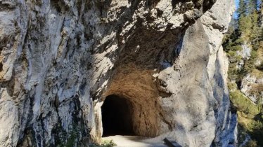
Eagle Walk Stage 6: Brandenberg Alps, © Tirol Werbung/Jens Schwarz
Eagle Walk Stage 6, © Tirol Werbung/Jens Schwarz

Eagle Walk Stage 06: Pinegg - Steinberg am Rofan

After a good night’s sleep in Pinegg, take a walk from the Gasthof Gwercherwirt Inn over the bridge across the Brandenberger Ache river and follow the Jägersteig path all the way to Aschau, a hamlet of Brandenberg. Take the paved road to get to Burgstallgraben, from where the path winds up to Wimm, Wimmerjoch peak and the old Lahnalm hut. From there, walk across Weißenbachgraben gorge to reach the “most beautiful end of the world”: Steinberg am Rofan. The surroundings are so beautiful that it is tempting to stay for a while, but use your new-found energy and continue on the Eagle Walk a little further. Cross the Steinberger Ache river to get to Vordersteinberg, then take the Bärenwald path through the forest to the cosy Waldhäusl guesthouse, where it is possible to stay overnight.

Interesting Facts

Eagle View · Steinberg am Rofan (1,010 metres above sea level) is nestled between the massif of the 2,195-metre Guffert mountain and three-peak Unutz mountain, which is part of the Rofan Mountains. HIkers can enjoy wonderful views from the cemetery in Steinberg: you will see not only the huge sky but also the alpine glow of the sun setting on the jagged slopes of the Klobenjoch in the Rofan Mountains.

Eagle Kick · Guffert mountain provides a rewarding grade 1 rock climbing opportunity. Climbers must have a good head for heights and be sure-footed. Hot in the height of summer, this climb is a delight in the early morning sun.

Interesting Facts Eagle View · Steinberg am Rofan (1,010 metres above sea level) is nestled between the massif of the 2,195-metre Guffert…

Read moreShow less
Open interactive map

Starting point  

Gwercherwirt (Pinegg)

Finishing point

Waldhäusl (Steinberg)

Mountain chain

Brandenberg Alps (Rofan)

Length

17.8 km

Total hiking time

7h

Features

  • Wheelchair-accessible Hiking Route
  • Circular hike

Difficulty rating

intermediate (red mountain trails)

Altitude

1,330m 675m

Elevation uphill 1,016m
Vertical metres downhill 691m

Fitness level

Technique

Best time of year

Jan
Feb
Mar
Apr
May
Jun

Jul
Aug
Sep
Oct
Nov
Dec

* These are approximate values and recommendations. Please take your personal fitness level, technical ability and the current weather conditions into account. Tirol Werbung cannot guarantee that the information provided is correct and accepts no liability.

Eagle Walk

This is a stage of the Eagle Walk, Tirol's most famous long-distance hiking trail.

Downloads

Trail description

Starting point: Gasthof Gwercherwirt (Pinegg)

Start out in Pinegg and cross the Brandenberger Ache and Steinberger Ache rivers via two beautiful bridges. Once across the rivers, continue up through magnificent old-growth forest on a hiking trail that eventually merges onto a forest road and rejoins Jägersteig path later, taking you to Aschau, which is a tiny settlement of Brandenberg.

Food & drink: Jodlerwirt, Haaser

Climbing steeply, the trail works its way up to the last farm named "Wimm". After the cattle grid, turn right and continue to follow the signs as far as the Wimmerjoch ridge. Here, at the highest point on today's stage, it is worth taking a break in the lush green meadows. Then stay left and head down towards the Lahnalm hut. Shortly before reaching the hut, follow the path to "Weißenbachgraben". As soon as you have crossed the Weißenbach, marking the border between Brandenberg and Steinberg, it is just a short stretch to the impressive Enterhof farmstead, where it is possible to stay the night. Continue past the farmstead and down to Steinberger Loch, crossing the Steinberger Ache river for the second time. Then take the first turning right onto the "Hinterbergweg" path. Follow it north as far as Vordersteinberg, cross the road and continue to the  "Bärenwaldweg" path. All that remains is to follow this trail to the idyllic Gasthof Waldhäusl on the western edge of Steinberg. Hikers can stay the night here.

Finishing point: Gasthof Waldhäusl (Steinberg)

Information on place

Arrival date

How to get here by plane, train, bus or car.

Ihr Ziel: Eagle Walk Stage 06: Pinegg - Steinberg am Rofan (47.5185429,11.8973162)

powered by Rome2Rio

Search accommodation

Number of travelers

Hiking trails in this region

show more +

How did you like this article?

Want to receive an answer? If so, please get in touch using the contact form.

Go up

Is your inbox in need of a holiday?

Then subscribe to our weekly newsletter full of exclusive holiday tips from Tirol!