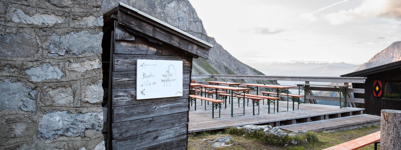
Eagle Walk Stage 21, © Tirol Werbung/Dominik Gigler

Eagle Walk Stage 21: Steinsee Hütte - Memminger Hütte

Ranking among the supreme ridge-running, cloud-probing, flower-swaying, peak-peering jaunts in all of the Lechtal Alps, this stage to the Memminger Hütte hut will have you hopping with joy with its nonstop horizon-spanning views of jagged ridges, cirques, flanks and colossal summits, though you'll work hard to reap those rewards. Once on the ridgetop, the trail passesthe 2,657-metre Großbergspitze mountain and 2,612-metre Großbergkopf peak along a precipice that is assisted by a fixed anchoring system of cables. A vigorous climb switchbacks up to the Seescharte ridge. Beyond, it’s a knee-jarring descent to the Memminger Hütte, where a necklace of three sparkling alpine lakes is flanked by rocky peaks.

Interesting Facts

Eagle View · From this peak-packed, view-granting ridge high in the Lechtal Alps, stand mesmerised, frozen in awe, utterly fixated by the Patroltal Valley. Gaze down to the valley end, carpeted in vivid greenery and sprinkled with delicate-needled larches. From the top of Großbergspitze peak you can enjoy a superb panorama of nearly every peak in the surrounding area.

Eagle Kick · You’ll need to turn your focus from the scenery to your feet as you tackle the steep and exposed descent from the Großbergkopf peak. Peak baggers may want to nab the two Spießrutenspitzen summits, including a bit of scrambling (rated II and IV on the climbing difficulty scale).

Tip! There is a Black Diamond Service Station at the Württemberger Haus, where hikers who have broken a walking pole or lost a glove can get a free replacement.

Interesting Facts Eagle View · From this peak-packed, view-granting ridge high in the Lechtal Alps, stand mesmerised, frozen in awe, utterly…

Read moreShow less
Open interactive map

Starting point  

Steinseehütte

Finishing point

Memminger Hütte

Mountain chain

Lechtal Alps

Length

13.5 km

Total hiking time

8h

Features

  • Wheelchair-accessible Hiking Route
  • Circular hike

Difficulty rating

difficult (black trails)

Altitude

2,649m 2,000m

Elevation uphill 1,270m
Vertical metres downhill 1,087m

Fitness level

Technique

Best time of year

Jan
Feb
Mar
Apr
May
Jun

Jul
Aug
Sep
Oct
Nov
Dec

* These are approximate values and recommendations. Please take your personal fitness level, technical ability and the current weather conditions into account. Tirol Werbung cannot guarantee that the information provided is correct and accepts no liability.

Eagle Walk

This is a stage of the Eagle Walk, Tirol's most famous long-distance hiking trail.

Downloads

Trail description

Starting point: Steinseehütte

From the Steinseehütte, hike downhill for a short distance, then climb gently up to the Steinkarscharte. Behind this, you cross grassy slopes and scree slopes before the trail climbs more steeply through rocks and then gravel to the Roßkarscharte. After the saddle, descend steeply in a narrow rocky gully where ropes are stretched, later descending into a basin on scree in the slightly wider cirque. The route then crosses meadow slopes and scree slopes and climbs moderately. Finally, the route climbs steeply up to the Gebäudjoch. Behind it, things get a little uncomfortable: the route descends steeply on black earth and a poor, unsecured path and over to grassy slopes. Cross these and then follow the path in serpentines down to the Württemberger Haus (2,220 meters), which is beautifully nestled in the round basin of the Obermedriol. (The Württemberger Haus is closed for overnight stays in 2024)

Descend a few metres from the Württemberger Haus on a singletrack trail. Then, the route crosses gently ascending tussock slopes and a scree slope before leading across a sometimes steep rock-strewn grass flank, assisted by a fixed anchoring system of cables, to the ridge. Now climb up to the summit of the Großbergspitze peak with its simple timber cross, alternately on the left and right side of the ridge on a relatively level path heading northward. Catch your breath and scan the horizon. How many of the summits of the Lechtal Alps can you name? From the Großbergspitze peak, the route gently descends along the spine of the ridge for a short distance. The trail climbs to a rock outcrop that has permanently fixed cables for protection. Then, it’s just a few steps up to the Großbergkopf mountain. Now, the route steeply descends on an exposed rubble-strewn singletrack trail left of the ridge, passing Großbergjoch ridge. Thereafter, the trail crosses tussock slopes, descending for a short distance, but soon resumes its climb, traverses a rubble cirque and runs up to the Seescharte ridge. The last rocky run will tax your strength and endurance, but finally you'll be atop the ridge. Beyond the ridge, the trail descends across scree, talus and earthy soil; it runs above a little ravine and leads into a world of wide open meadows. Finally, pass the largest lake around the hut before arriving at the finishing point: Memminger Hütte, in a rugged bowl at an elevation of 2,242 metres under the reign of majestic peaks.

Finishing point: Memminger Hütte

Information on place

Arrival date

How to get here by plane, train, bus or car.

Ihr Ziel: Eagle Walk Stage 21: Steinsee Hütte - Memminger Hütte (47.22611,10.5873)

powered by Rome2Rio

Search accommodation

Number of travelers

Hiking trails in this region

show more +

How did you like this article?

Want to receive an answer? If so, please get in touch using the contact form.

Go up

Is your inbox in need of a holiday?

Then subscribe to our weekly newsletter full of exclusive holiday tips from Tirol!