Eagle Walk Stage 16, © Tirol Werbung/Dominik Gigler

Eagle Walk Stage 16: Leutasch/Ahrn - Ehrwald

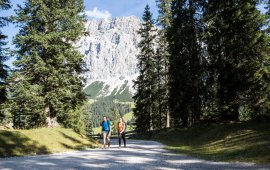
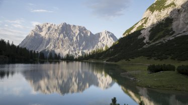
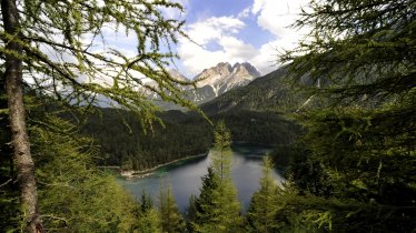
Venture to where the deer and the mountain goats play - and to an area of awesome natural beauty. It’s a long journey at about 23 kilometres, but manageable. Walking along Leutascher Ache river and Gaistalbach stream, take in old-growth forest and acres of amazing meadows and pastures en route. Follow the Ganghoferweg trail to the Hämmermoosalm hut and further into the valley to Gaistalalm and Tillfussalm huts, where you will find the former hunting lodge of writer Ludwig Ganghofer. The route continues between the Mieming Mountains and Wetterstein Mountains, with peaks that become more and more striking as you hike on. A gentle climb takes to up to the Igelsee lake, where the Leutascher Ache river has its headwaters. Amble down to Ehrwalder Alm and to the top of the Ehrwalder Alm gondola on a forest road. From there, a marvellous footpath winds down to the village of Ehrwald towered over by the Zugspitze, Germany's highest mountain.

Interesting Facts

Eagle View ·The former primary school in Leutasch today houses the Ganghofer Museum Cultural Centre and a public library. The museum provides insights into the life and work of Ludwig Ganghofer (1855–1920), a German writer who became famous for his patriotic novels. The “Haus Hubertus” (Ganghoferhaus Lodge or Ganghofer Hunting Lodge) building above the Tillfussalm hut is in private hands today. In front of it, a commemorative bust has been erected in honour of the poet, looking down on visitors behind glasses.

Eagle Kick ·At the end of Gaistal Valley lies a magnificently remote place, a high valley of old-growth forest where deer wander down into the meadows at dusk and back up the hillsides at dawn. In September and October, the haunting calls of stags in the midst of their mating season echo across the meadows and woods. You might even perhaps spot amorous stags bugling their challenges, each seeking the right to mate.

Interesting Facts Eagle View ·The former primary school in Leutasch today houses the Ganghofer Museum Cultural Centre and a public library…

Read moreShow less
Open interactive map

Starting point  

Leutasch, Ahrn

Finishing point

Ehrwald

Mountain chain

Wetterstein Mountains

Length

23 km

Total hiking time

7h

Features

  • Wheelchair-accessible Hiking Route
  • Circular hike

Difficulty rating

easy (hiking trails)

Altitude

1,590m 980m

Elevation uphill 590m
Vertical metres downhill 730m

Fitness level

Technique

Best time of year

Jan
Feb
Mar
Apr
May
Jun

Jul
Aug
Sep
Oct
Nov
Dec

* These are approximate values and recommendations. Please take your personal fitness level, technical ability and the current weather conditions into account. Tirol Werbung cannot guarantee that the information provided is correct and accepts no liability.

Eagle Walk

This is a stage of the Eagle Walk, Tirol's most famous long-distance hiking trail.

Public transport

  • Accessible using public transport

Downloads

Trail description

Starting point: Ahrn

Start off in Ahrn (a hamlet of the village of Leutasch) at the bridge over Leutascher Ache river (the starting point for hikes onto the Hoher Sattel) and take the footpath that heads towards “Weidach”. Shortly after, the path crosses onto the right-hand side of the river. Here, follow signage to “Unterweidach” and/or “Achweg Weidach”. Then follow the Leutascher Ache river on its right side downstream along the Achenweg trail until you reach the Kalvarienberg mountain at the entrance to the Gaistal Valley. Cross the river on an iron footbridge, walk a few metres into the valley, cross to the right side of the river at the toll booth and continue on the path into the valley. Before you reach Salzbach car park, follow signage to “Almenparadies Gaistal” and cross the river again. Then, however, do not follow the path to the parking area but turn left before, taking the broad roadway into the Gaistal Valley. After a few metres, branch off to the right and head onto the “Ganghoferweg” trail. This is a broad footpath that steeply ascends for a short while at the beginning. Thereafter, the route gently ascends through thinning forest and runs along meadows, passing below Hämmermoosalm hut and heading towards the end of the valley (“Gaistalalm”, “Tillfussalm”). The path crosses Leitenbach stream and descends a few metres down to Gaistalalm hut, which is the end of Ganghoferweg trail. After your stop-off at the hut, continue in the same direction across alpine pastures until you reach Tillfussalm hut. Soon, the footpath changes into a singletrack trail. It enters the forest and slightly ascends. Then it descends very gently down to Tillfussalm hut.

Food & drink: Gaistalalm, Tillfussalm

From there, continue westward on the broad valley path running parallel to the Leutascher Ache river and Gaistalbach stream. At the fork, walk straight ahead following signage to “Ehrwalder Alm über Igelsee”. The route runs between the Mieming Mountains on the left and Wetterstein Mountains on the right with peaks that become more and more striking as you hike on. Altogether, the path gently ascends and leads to Igelsee lake. Behind the lake, bear right at the fork and follow the steep path up to an elevation of 1,600 metres. Follow the forest road down to Ehrwalder Alm hut and to the top of the Ehrwalder Alm gondola.

Food & drink: Ehrwalder Alm, Tirolerhaus, Alpenglühn, Brentalm (bottom of cable car)

Below the Ehrwalder Alm hut, the signed (“Wiesenweg nach Ehrwald”) meadow path to Ehrwald starts. First, it leads across the ski resort. At the fork, go straight ahead, then bear right and proceed on a steep portion through the forest. Thereafter, the footpath leads across marvellous mountain meadows and pastures over to the base of the Ehrwalder Alm gondola. From there, you get to Ehrwald on the Altmühlensteig trail, which starts a few metres southwest of the base on the left side of the Gaisbach stream downstream.

Finishing point: Ehrwald

Information on place

Arrival date

How to get here by plane, train, bus or car.

Ihr Ziel: Eagle Walk Stage 16: Leutasch/Ahrn - Ehrwald (47.3699749,11.1438354)

powered by Rome2Rio

Search accommodation

Number of travelers

Hiking trails in this region

show more +

How did you like this article?

Want to receive an answer? If so, please get in touch using the contact form.

Go up

Is your inbox in need of a holiday?

Then subscribe to our weekly newsletter full of exclusive holiday tips from Tirol!