Eagle Walk Stage 15: Eppzirler Alm, © Tirol Werbung / Kranebitter Klaus

Eagle Walk Stage 15: Solsteinhaus - Leutasch/Ahrn

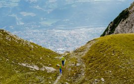
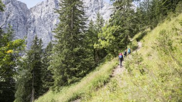
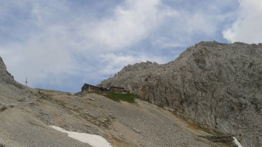
From the Solsteinhaus it’s steep climbs and rock scrambles north-westward towards Eppzirler Scharte. The trail works its way up to the ridge that offers superb close-ups of the Großer and Kleiner Solstein peaks, the mighty western cornerstones of the Nordkette Mountains. Beyond a scree cirque, a well-maintained trail switchbacks down and merges into lush alpine meadows at an elevation of around 1,700 metres, taking you to the charming Eppzirler hut with its tiny chapel. From there you begin your descent into Eppzirlertal Valley on a broad road that follows Gießenbach stream across the Gießenbachklamm ravine on a rugged trail. From Gießenbach the trail heads to Scharnitz, and across the Hoher Sattel and through thinning forest to Leutasch/Ahrn.

Interesting Facts

Eagle View ·Step back in time and explore the remains of an old defensive stronghold. A mighty bulwark, the 17th century Porta Claudia, was built during the Thirty Years War under the reign of Claudia di Medici as a stronghold between Bavaria and Tirol. The once mighty fortress was largely destroyed, but some vaults and an imposing ditch still remain. With its weathered crags and pinnacles, Gießenbachklamm ravine is a spectacular natural sight. In mid-summer, the creek is but a trickle. A viewing bench along the trail affords stunning views of rugged Karwendel Mountains.

Eagle Kick ·The striking Große Arnspitze mountain is one of the most prominently recognizable peaks in the area, standing alone between the Wetterstein and Karwendel Ranges. It's a little long, a little steep and a little challenging getting to the top, and the actual summit is a rock-scramble. But the scenic rewards? They're breathtaking! Savour one of the finest vantages for admiring the Bavarian foothills of the Alps, Walchensee lake, the and rugged and lofty Karwendel and Wetterstein Mountains. If you can ever move your eyes away from these mesmerising mountains, a multitude of others demand your attention as well, from the Ötztal Alps to the Stubai Alps.

Interesting Facts Eagle View ·Step back in time and explore the remains of an old defensive stronghold. A mighty bulwark, the 17th century…

Read moreShow less
Open interactive map

Starting point  

Solsteinhaus

Finishing point

Leutasch/Ahrn

Mountain chain

Karwendel Mountains

Length

20 km

Total hiking time

6 h 30 min

Features

  • Wheelchair-accessible Hiking Route
  • Circular hike

Difficulty rating

intermediate (red mountain trails)

Altitude

2,110m 1,000m

Elevation uphill 870m
Vertical metres downhill 1,530m

Fitness level

Technique

Best time of year

Jan
Feb
Mar
Apr
May
Jun

Jul
Aug
Sep
Oct
Nov
Dec

* These are approximate values and recommendations. Please take your personal fitness level, technical ability and the current weather conditions into account. Tirol Werbung cannot guarantee that the information provided is correct and accepts no liability.

Eagle Walk

This is a stage of the Eagle Walk, Tirol's most famous long-distance hiking trail.

Downloads

Trail description

Starting point: Solsteinhaus

From the Solsteinhaus lodge, follow signage to “Eppzirler Scharte” and/or “Eppzirler Alm”. First, a waymarked path leads across the wide open alpine meadows of Erlalm. Thereafter, the path continues across scree, talus and rugged terrain over to the beginning of the scree cirque and upward to Eppzirler Scharte. On the climb across the cirque, the path forks; follow signed (“Eppzirler Scharte”) track no. 212. Climbing steeply, the trail works its way up to the ridge located between Kuhlochspitze peak and Erlspitze peak. Beyond, walk on a well-maintained path across Kuhloch scree cirque, which is steep on its top and then becomes wide and shallow. From here, the path zigzags down and merges into lush alpine meadows at an elevation of approximately 1700 metres. After another short steep ascent with scree, you finally reach the alpine valley floor. From here, the path gently descends and leads to Eppzirler hut, running parallel to the (dry) stream bed.

Food & drink: Eppzirleralm, Gasthof Ramona

From the pasture hut, you leisurely descend on a broad roadway across grazing pastures to the Eppzirler Tal Valley and continue in the same direction heading towards the entrance of the valley. Pass the branch-off to Oberbrunnalm hut (elev. 1,200 m) and continue on the gently descending path that leads out of the valley. The roadway now runs along the Gießenbach stream (alternately on the left and right side of the creek) into Gießenbachklamm gorge. The gorge is wooded at the outset and is then becoming rockier and rockier. After the gorge, the path leads to the parking area for the Eppzirleralm hut in Gießenbach (a hamlet of Scharnitz). Cross the railway tracks and the main road. In the village, take the first road to the right heading towards Scharnitz. Then, turn left towards “Hoher Sattel”. Further on, proceed in the direction of “Bogenschiessstand” and/or “Scharnitz” and branch off to the left towards “Leutasch”. Then, bear right onto a forest road towards “Leutasch über hohen Sattel”. After this short level portion in Gießenbach, the forest road ascends with moderate steepness and then leads gently up through thinning forest to Sattelklamm gorge. From the end of the road, a path runs along the slope through groves and climbs vigorously in its middle section. The path turns onto a trail. Follow signage to “Leutasch/Ahrn” until you reach Hoher Sattel. Beyond the saddle, a (sometimes quite steep) forest road through thinning forest takes you down to Leutasch/Ahrn and to Leutascher Ache bridge across Satteltal Valley. Do not branch off to the left straight before you reach your destination.

Finishing point: Leutasch

Information on place

Arrival date

How to get here by plane, train, bus or car.

Ihr Ziel: Eagle Walk Stage 15: Solsteinhaus - Leutasch/Ahrn (47.3080521,11.288149)

powered by Rome2Rio

Search accommodation

Number of travelers

Hiking trails in this region

show more +

How did you like this article?

Want to receive an answer? If so, please get in touch using the contact form.

Go up

Is your inbox in need of a holiday?

Then subscribe to our weekly newsletter full of exclusive holiday tips from Tirol!