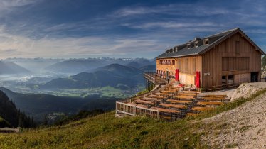
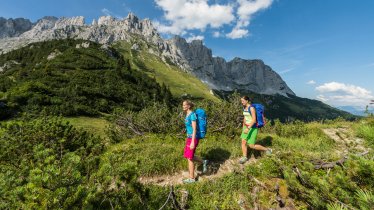
This difficult three-day hike leads along the mighty rock faces on the south side of the Wilder Kaiser. Measuring 25 kilometres and with around 2,100 vertical metres of uphill from start to finish, it leads from the village of Going via Hüttling, the Schleierwasserfall waterfall and the Baumgartenköpfl mountain to the Gaudeamushütte hut. Day two with its summit ascent of the Hinterer Goinger Halt and the tricky Jubiläumssteig trail requires alpine experience, good fitness, sure footing and a head for heights. The route then continues from the Gruttenhütte along the Wilder-Kaiser-Steig to the Steiner-Hochalm hut and on to the Hinterschießlingalm hut, where the dishes prepared using beef from the Angus cows grazing in the surrounding pastures is highly recommended. The final section leads through the Rehbachklamm to Scheffau. This walk is ideal for a long weekend and is aimed at classic mountain hikers. The three stages can each be completed in a maximum of five and a half hours. Various approaches as well as easy and difficult alternative routes allow for flexible and individual route planning.

Starting point
Going
Finishing point
Scheffau
Mountain chain
Kaiser Mountains
Length
24.6 km
Duration
3 day(s)
Features
- Wheelchair-accessible Hiking Route
- Circular hike
Difficulty rating
difficult (black trails)
Altitude
Elevation uphill 2,060m
Vertical metres downhill 2,140m
Fitness level
Technique
Best time of year
* These are approximate values and recommendations. Please take your personal fitness level, technical ability and the current weather conditions into account. Tirol Werbung cannot guarantee that the information provided is correct and accepts no liability.
Public transport
- Accessible using public transport
Bus route 4060, get off at stop Going a. W. K. Dorf
Parking
Going, car park next to the local fire brigade building
Places serving food & drink
- Stage 1: Graspoint-Niederalm (mid-May until October), Obere Regalm (early June until early October), Gruttenhütte
- Stage 2: Kaiser-Hochalm (only open sporadically in summer), Steiner-Hochalm, Berggasthof Bärnstatt, Seestüberl
- Stage 3: Walleralm (Stöfflhütte), Steiner-Hochalm, Hinterschießlingalm, various locations in Scheffau
Trail description
Stage 1: Going (car park next to local fire brigade building) – Gruttenhütte
Vertical metres uphill/downhill: 1,155/375 vertical metres, walking time: 5 hours 30 minutes, distance: 8 kilometres, highest point: 1,620 metres, difficulty rating: intermediate (red trails)
The first stage begins at the local fire brigade building in Going. Take trail number 817 to the Graspoint-Niederalm hut (1,075 metres) and then on to the Obere Regalm hut (1,313 metres), a good place for a rest and a snack. Continue on the Wilder-Kaiser-Steig trail 827 through open meadows and then later along a steep uphill section to Baumgartnerköpfl and then in a westerly direction to the Gaudeamushütte.
Stage 2: Gaudeamushütte – Gruttenhütte
Vertical metres uphill/downhill: 1010/660 vertical metres, walking time: 5:30 hours, distance: 5.9 kilometres, highest point: 2,192 metres, difficulty rating: difficult (black trails)
Day two sees hikers take on the Jubiläumssteig, a challenging trail with lots of iron handholds and footholds as well as a steel rope anchored into the rock for extra safety on the most exposed sections. This trail leads to the Ellmauer Tor. From there, a difficult trail continues to the summit of the Hinterer Goinger Halt. Return along the way you came. From the turning off to the Jubiläumssteig it is not far to the Gruttenhütte (1,620 metres), where this stage concludes.
Stage 3: Gruttenhütte – Scheffau
Vertical metres uphill/downhill: 190/1,060 vertical metres, walking time: 4:30 hours, distance: 11.4 kilometres, highest point: 1,620 metres, difficulty rating: intermediate (red trails)
From the Gruttenhütte the route leads via the Wilder-Kaiser-Steig to the Kaiser-Hochalm hut (closed to the public) and then on to the Steiner-Hochalm (1,257 metres) and the Hinterschießlingalm, where you can try some of the local dishes prepared using meat from the Angus cows which graze on the surrounding meadows. The last section of this last stage is through the Rehbachklamm gorge into the centre of Scheffau. There is a free shuttle bus ("KaiserJet") which can be used to travel back to the starting point in Going.


