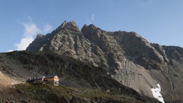
This circular hike on the Kaunergrat ridge links two easily accessible huts above the village of St. Leonhard im Pitztal: the Arzler Alm and the Tiefental-Alm. It offers wonderful views of the 3,353-metre-high Rofelewand, passing through thick forests along the way. Autumn is the best time of year to admire the wonderful colours as the leaves turm red, yellow, gold and brown. Those who want a little more adventure can extend the hike to take in the Kreuzjoch mountain.

Mountain Pasture Hike
Starting point
Scheibe car park, St. Leonhard im Pitztal
Hike to
Arzler Alm, Tiefental-Alm
Finishing point
Scheibe car park, St. Leonhard im Pitztal
Mountain chain
Ötztal Alps
Length
8 km
Total hiking time
4h
Features
- Wheelchair-accessible Hiking Route
- Circular hike
Difficulty rating
intermediate (red mountain trails)
Altitude
Elevation uphill 582m
Vertical metres downhill 569m
Fitness level
Technique
Best time of year
* These are approximate values and recommendations. Please take your personal fitness level, technical ability and the current weather conditions into account. Tirol Werbung cannot guarantee that the information provided is correct and accepts no liability.
Public transport
- Accessible using public transport
Parking
Scheibe car park, St. Leonhard im Pitztal
Places serving food and drink
- Arzler Alm
- Tiefental-Alm
Please enquire in advance for details on opening times.
Downloads
Trail description
The car park at Scheibe, near St. Leonhard im Pitztal, is the starting point for this hike. Just before you reach the "Restaurant zu Einkehr" (building number 64), a bridge leads over the Pitze river. It is here that the trail up to the Arzler Alm begins. Cross over the wide forest track and follow the steep path up through the woods. After around 40 minutes this path meets the wider forest track once again. Follow this track for a few minutes, then at the next right-hand corner turn left once again and back onto the smaller path. Complete the final 250 vertical metres along this path up to the Arzler Alm hut at almost 1,880 metres above sea level. After passing the hut, the route heads gently downhill along the forest track towards the Tiefental-Alm. After just a few metres on the forest track, keep an eye out for the first right-hand corner and switch there onto the narrower path. Things head uphill again here, through a section of forest. At around 1,910 metres the descent to the Tiefental-Alm hut begins. The route back to the starting point in Schreibe is along a forest trail full of twists and turns.
Important! Hikers keen to extend the route to take in a mountain peak can walk from the Arzler Alm hut up to the top of the Kreuzjoch (2,300 metres anobe sea level). At the Arzler Alm, take the trail heading south towards the Rappenkopf mountain. From the top of the Kreuzjoch mountain there is a steep descent down to the Gschwandtbach and then on to the Tiefental-Alm. Adding this extra section will increase the overall walking time by around 2.5 hours.


