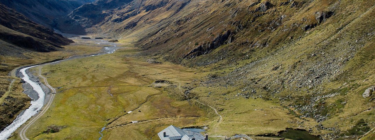
This ride leading along tarmac and smooth gravel climbs around 1,000 vertical metres from start to finish, with a total distance of 24.7 kilometres. It begins in Längenfeld in the Ötztal Valley and takes riders to the Amberger Hütte hut. Along the way you can look forward to fine views as you make your way through in the idyllic Sulztal Valley at the foot of the Breiter Grießkogel. The Amberger Hütte hut serves hearty local food. There is also a recharging point there for riders to plug in and charge up their e-bikes while they eat.

Mountain Bike Ride
Starting point
Aqua Dome in Längenfeld
Hike to
Amberger Hütte
Finishing point
Aqua Dome in Längenfeld
Mountain chain
Stubai Alps
Length
24.7 km
Features
- Circular route
- Handicap-accessible
- Route with e-bike charging station
- Amberger Hütte
- E-bike recharging point by Ötztaler Ache river, Unterlängenfeld 81
Difficulty rating
medium
Altitude
Elevation uphill 998m
Vertical metres downhill 998m
Fitness level
Technique
Best time of year
* These are approximate values and recommendations. Please take your personal fitness level, technical ability and the current weather conditions into account. Tirol Werbung cannot guarantee that the information provided is correct and accepts no liability.
Parking
- Parking available in Unterlängenfeld
- Gries car park (Oberlängenfeld 72)
Places serving food & drink
- Various locations in Gries
- Sulztalalm
- Amberger Hütte
- Brandalm in Oberlängenfeld (approx. 1 km detour)
- Various locations in Längenfeld
Downloads
Trail description
Route 694 begins at the Aqua Dome spa in Längenfeld and leads along the Albin-Egger-Lienz-Fischbachpromenade in an easterly direction. Cross over the stream after a few metres and, on the Ötztalstraße road, continue north. At the roundabout, take the first exit (right) onto the Grieser Straße and follow the steep switchbacks uphill. The road leads 5.4 kilometres into the Sulztal Valley, via Grantbichl and the Unterlehner Fischbachalm hut, to the Gries place of pilgrimage. Pass through Gries. After the car park at the start of the settlement, cross the small stream called the Winnebach and continue for 1.2 kilometres through the Sulztal Valley. At almost 1,680 metres above sea level there is a bridge over the Fischbach stream onto the other side. After the bridge, follow the forest trail straight on uphill. Take the corner and, at the next crossroads, don't head towards Nisslalm but instead take route 694 on further into the Sulztal Valley towards the Amberger Alm hut. After 2 kilometres you will see the Sulztalalm hut. From there it is just 2.3 kilometres and 240 vertical metres to the Amberger Hüte hut at 2,134 metres above sea level. Shortly before you get there you will reach the Hintere Sulztalalm hut (closed). The route back to Längenfeld leads from the Amberger Hütte back along the way you came. At the crossroads to the Nisslalm, stay on the left-hand side of the Fischbach stream. Opposite Gries, pass the Tiroler Hütte and keep heading out of the valley through the Nederwald forest. Shortly before you reach Längenfeld you will cross the Alzenrinne and then the Söhrinne before passing Brand, below the Brandalm hut, and descending via switchback corners to Längenfeld.


