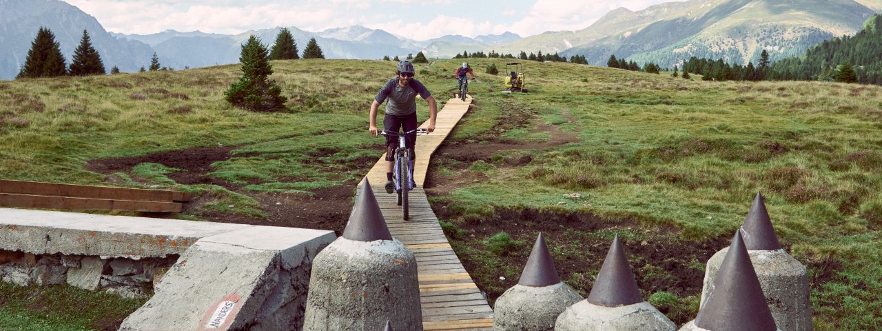
With its cross-border flair and fantastic views of the Reschensee lake, the Plamort Trail is one of the classic trails in the 3 Countries Enduro Trails region. It is relatively long at 5.5 kilometres and leads through historical sights such as tank defences near the Italian border as well as lush meadows, thick forests and section of loose stones and rocks. The last part is characterised by many tight turns. The descent from the top at Bergkastel down to the Reschensee lake is divided into four sections, which are all rated either S1 or S2.


Singletrack

"The Plamort Trail takes riders from Austria into Italy and contains everything that makes downhill riding so much fun. The view at the start is amazing. Riders can then look forward to a steep, rocky descent full of speed and flow all the way back to civilisation near the shores of the Reschensee lake."
Benedikt Purner, downhill tider & trail builder
Starting point
Bergkastelalm
Finishing point
Nauders
Mountain chain
Sesvenna Alps
Length
5.5 km
Riding time
0 h 36 min
Features
- Circular route
- Handicap-accessible
- Route with e-bike charging station
Difficulty rating
Singletrack intermediate
Altitude
Vertical metres downhill 735m
Fitness level
Technique
Best time of year
* These are approximate values and recommendations. Please take your personal fitness level, technical ability and the current weather conditions into account. Tirol Werbung cannot guarantee that the information provided is correct and accepts no liability.
Parking
Car park at the bottom of the Bergkastelbahn cable car
Downloads
Trail description
Travelling from Nauders towards Italy, visitors will see to their left the brand new bottom station of the Bergkastelbahn cable car transporting passengers to 2,172 metres above sea level. The descent from the top of the cable car over the border to the village of Reschen on the shores of Reschensee lake is known among riders as the "Plamort Trail", though in fact it is made up of four separate trails: Almtrail (86), Plamort Trail (71), Bunker Trail (101) and Etsch Trail (102).
At the top of the cable car riders will immediately see a trail map on a wooden church spire. Follow the signs for the Almtrail past the Stieralm hut to Hochebene Plamort. Here is the start of the Plamort Trail (S1). The terrain is undulating and flowy as it leads through meadows and the mighty tank defences at the Austria-Italian border. Follow the trails all the way to the military bunkers. Then it is time for the Bunker Trail (S2), which forms the main connection to Reschen. The first section is fast and not too steep, but then the terrain becomes more challenging with roots and rocks. After a few fast and flowy traverses through the forest the trail follows the mountainside to the start of the Etsch Trail (S2). This comprises many tight swichbacks with loose earth and rocks, requiring good bike-handling skills. This final section is without a doubt the most technically difficult and is rated S3 in certain sections. After 680 vertical metres of pure fun riders arrive in the village of Reschen.
There are several ways to get back to the start: The bottom station of the Schönebenbahn cable car can be reached in just a few minutes by riding along the shore of the Reschensee lake. There, riders can take the cable car up and ride down the Oberer Schöneben Trail (98) via the Reschner Alm hut and the 3 Countries Enduro Trail (65) to the Mutzkopf mountain and down to Nauders. An alternative for those who are already tired is to take the Via Claudia Augusta cycle path from Reschen back to Nauders.
The Plamort Trail is part of the 3 Countries Enduro Trails, a network of trails near the Reschenpass mountain pass where Austria, Italy and Switzerland converge. The network comprises four cable cars and 21 trails. For more information about the 3 Countries Enduro Trails visit www.nauders.com.
Tip! The 3 Countries Summercard Gold Bike gives riders access to all cable cars and trails. It is available from local tourism offices.


