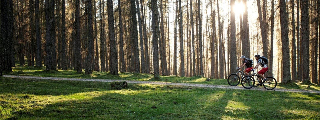
Coursing across awe-inspiring valleys, rugged mountain ranges, lush forests and remote mountain lakes, the three-day Zugspitz Loop is a snippet of classic Tirol. Mellow cruising through forest and meadows, impressive climbs and roaring descents - you name it, the Zugspitz Loop has it. This wonderful ride is a good test of one’s stamina and abilities, with its 194 kilometres and 5,900 vertical metres of climbing. There are plenty of e-bike charging stations along the way.

Mountain Bike Ride
Starting point
Imst
Finishing point
Imst
Mountain chain
Wetterstein Mountains
Lechtal Alps
Mieming Mountains
Length
198.9 km
Duration
3 day(s)
Features
- Circular route
- Handicap-accessible
- Route with e-bike charging station
Difficulty rating
difficult
Altitude
Elevation uphill 4,650m
Vertical metres downhill 4,660m
Fitness level
Technique
Best time of year
* These are approximate values and recommendations. Please take your personal fitness level, technical ability and the current weather conditions into account. Tirol Werbung cannot guarantee that the information provided is correct and accepts no liability.
Parking
Imst: parking at the Imster Bergbahnen cable cars (free), further parking options near the parish church
Reutte: Urisee car park, further parking options in the town
Seefeld: parking at the bottom of the Gschwandtkopf cable cars or the bottom of the Bergbahnen Rosshütte ski lifts
Places serving food & drink
Day 1
- Various locations in Imst, Nassereith and Reutte
- Gasthof Aschlandhof
- Marienbergalm
- Sunnalm
- Waldhaus Talblick
Day 2
- Hotel Forelle am Plansee
- Musteralpe Plansee
- Grenzstüberl Griesen
- Gasthof Gaistaler Hof
- Ganghofer Hütte
- Ehrwalder Alm
- Tiroler Haus
- Berggasthof Alpenglühn
- Tillfussalm
- Gaistalalm
- Muggenmoosalm
- Wildmoosalm
- Various locations in Ehrwald, Leutasch and Seefeld
Day 3
- Seewaldalm
- Gasthof Gerhardhof, Wildermieming
- Various locations in Telfs, Mieming, Obsteig, Nassereith, Tarrenz and Imst
Downloads
Trail description
Day 1: Imst - Reutte
Uphill/downhill: 1,554/1,525 vertical metres, distance: 67.2 kilometres, highest point: 1,806 metres, difficulty level: difficult
From the Oberstadt area of Imst, stage one leads along a wide forest trail next to the Pigerbach stream towards Tarrenz and then on to the village of Nassereith. Turn right towards Aschland. After around five kilometres the steep climb begins along route 605 to the Marienbergjoch ridge at around 1,800 metres above sea level. This is followed by a steep descent to the Weißensee lake, past the Sunnalm hut and the bottom of the Marienbergbahn ski lift. Once down in the valley, riders take route 814 to Ehrwald. Then head west past the village of Lermoos and through gently rolling terrain parallel to the Fernpassstraße road to Heiterwang. The last few kilometres lead through the Klausenwald forest and along the Echenbichler Landstraße road to the finishing point in Reutte.
Day 2: Reutte – Seefeld
Uphill/downhill: 1,470/1,150 vertical metres, distance: 64.5 kilometres, highest point: 1,599 metres, difficulty level: difficult
Leaving from Reutte, riders head towards Urisee. The gravel climb along route 824 leads via Kuhklause to the shore of the Plansee lake at almost 1,000 metres above sea level. The ride then continues along the wide route 820 across the border into Germany. Continue to Griesen fand then head south along the Loisach river to Ehrwald. From here there is a three-kilometre climb on tarmac and gravel which is steep in places and leads from the bottom of the Ehrwalder Almbahn cable car to the Ehrwalder Alm hut. The ride then continues past the Igelsee lake and down through the Gaistal Valley. After passing Obern, head along a gravel trail towards the Wildmoossee lake, past the Wildmoosalm hut, on route 547 to Seefeld.
Day 3: Seefeld – Imst
Uphill/downhill: 1,769/2,131 vertical metres, distance: 62.8 kilometres, highest point: 1,847 metres, difficulty level: difficult
The third and final stage begins with a section along route 546 from Seefeld heading south-west to Mösern. After a short section on the Möserer Dofstraße road, riders reach a singletrack trail around four kilometres in length heading down to Telfs. This is followed by rolling terrain across the Mieming Plateau all the way to Obsteig. Continue via Arzkasten and Holzleiten Sattel down to Nassereith before the final challenging climb of the day begins. This takes riders onto the Schweinsteinjoch ridge from Sankt Wendelin near Nassereith through the Tegestal Valley. There then follows a trail via the Vordere Tarrentonalpe hut onto the Dirstentrittkreuz mountain at 1,850 metres. The route back into the valley takes riders past Sinnesbrunn, the Kappakreuz mountain and Obtarrenz. From there, head to the centre of Tarrenz and then take the tarmac cycle path for the last few kilometres through the Gurgltal Valley back to Imst.
Important! You can replace the section from Nassereith through the Tegestal Valley and via the Schweinsteinjoch ridge to Tarrenz by instead taking the Radwanderweg Gurgltal cycle path from Nassereith.


