© Tirol Werbung
© Tirol Werbung

Bike Trail Tirol Stage 02: Weißenbach - Tannheim

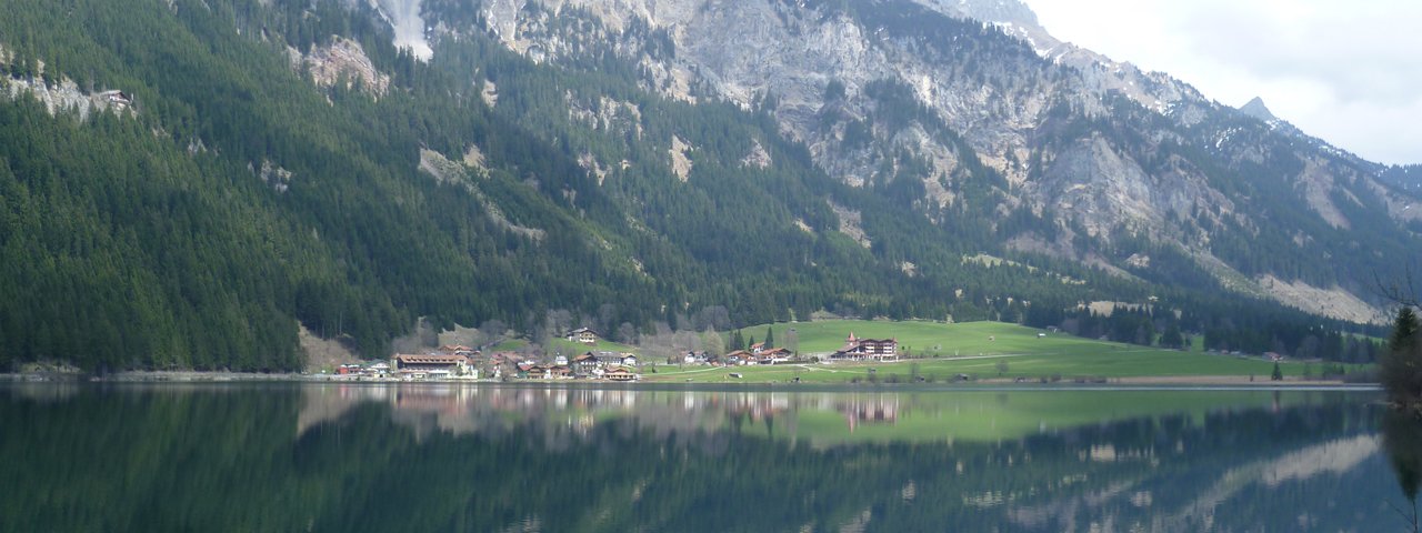
This route, covering only 17 kilometers, ranks among the short stages of the tour. But at the same time it is deeply rooted in history and boasts awesome landscapes of natural beauty. Pedaling past verdant meadows and crystal clear Haldensee Lake, you can explore some of the most pristine and idyllic parts of the Alps before you reach the end of the stage in Tannheim.

  • You conquer 250 varied meters of altitude gain on this scenic route of intermediate difficulty. Most parts of the track lead along convenient asphalt cycleways.
  • Right after the start of the tour in Weißenbach you conquer 250 meters of altitude, pedaling through a truly breathtaking alpine ravine. Here you are strongly recommended to stop and walk down into the gorge with its mighty rock walls on both sides.
  • As soon as you reach the valley bottom of Tannheimer Tal valley the splendid route travels without major difficulties across lush meadows and shady forests. Enjoy the fantastic landscape!
  • The moderate ascent towards Tannheimer Tal leads along the historical „Via Salina“ which used to be one of the most important salt trade routes in the past.
  • A magnificent valley formed by Berger Ache mountain brook is known as the „Alps' most scenic high-altitude valley“, surrounded by the picturesque mountains of Aggstein and Gimpel with their steep ridges and rock faces towering high above the region.

You conquer 250 varied meters of altitude gain on this scenic route of intermediate difficulty. Most parts of the track lead along convenient…

Read moreShow less
Open interactive map

Mountain chain

Allgäu Alps

Lechtal Alps

Length

17.1 km

Riding time

2 h 15 min

Features

  • Circular route
  • Handicap-accessible
  • Route with e-bike charging station

Difficulty rating

medium

Altitude

1,160m 890m

Elevation uphill 400m
Vertical metres downhill 190m

Trail description

On the first few hundred meters after the junction ‘Alter Gaichtpass – Tannheimertal’, cross Weissenbach am Lech and then follow the signposts to Tannheimertal before the bridge that runs over Weissenbach. After 500 meters, change to the other side of the stream to get to ‘Alte Gaichtpassstrasse’. Follow the gravel road above Weissenbachklamm until you reach Tannheimertalstrasse (B199). Cross the road and, after a short pushing section, you will get to a hamlet called Gaicht (about an hour from Weissenbach), which is already located on the valley floor of the Tannheimertal. Continue on the Tannheimertal cycling trail passing through woods and across pasture land until you get to the road. Pass north under the road for about 100 meters to get to the other side of the valley. Continue on the  cycling trail signposted to Tannheim. Pass Lake Haldensee on its south side, proceed through the village of Haldensee and then pass Grän on its south side. From there, it’s only 2 km across pasture land and fields until you get to Tannheim (always stay on the cycling trail). Before you reach the town, pass under the road again and you will get to the church after 200 meters (approx. 1 hour and 15 minutes from Gaicht).

Places along the route

Arrival date

How to get here by plane, train, bus or car.

Ihr Ziel: Bike Trail Tirol Stage 02: Weißenbach - Tannheim (47.439224,10.639664)

powered by Rome2Rio

Search accommodation

Number of travelers

How did you like this article?

Want to receive an answer? If so, please get in touch using the contact form.

Go up

Is your inbox in need of a holiday?

Then subscribe to our weekly newsletter full of exclusive holiday tips from Tirol!