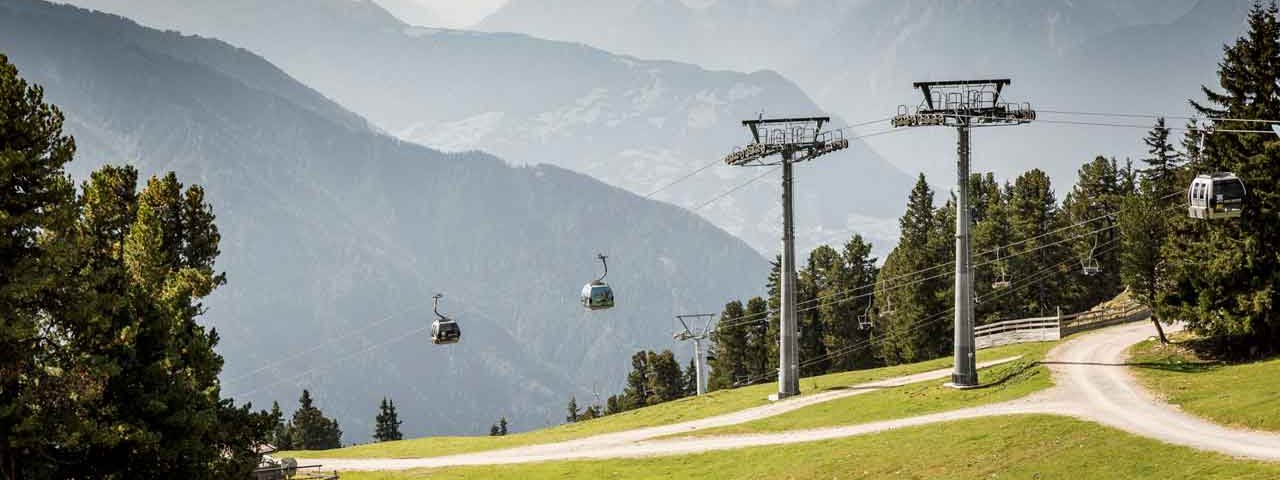
Measuring 37.9 kilometres in total, this one-day ride at the start of the Ötztal Valley begins with a ride on the cable car in Oetz. Up at the top, around 2,000 metres above sea level, riders can look forward to fantastic views of the surrounding landscape, including the Ötztal Alps and the Mieming Mountains. From the top of the cable car there are just 500 vertical metres more to climb, making this ride ideal for beginners. However, the descent back down into the valley is long (1,726 vertical metres) and requires good bike-handling skills in places as well as plenty of hand power on the brakes.

Mountain Bike Ride
Starting point
Oetz
Finishing point
Oetz
Mountain chain
Stubai Alps
Ötztal Alps
Length
37.9 km
Riding time
3h
Features
- Circular route
- Handicap-accessible
- Route with e-bike charging station
Difficulty rating
medium
Altitude
Elevation uphill 500m
Vertical metres downhill 1,730m
Fitness level
Technique
Best time of year
* These are approximate values and recommendations. Please take your personal fitness level, technical ability and the current weather conditions into account. Tirol Werbung cannot guarantee that the information provided is correct and accepts no liability.
Parking
Parking at the bottom of the Acherkogelbahn cable car in Oetz
Places serving food & drink
- Panoramarestaurant Hochoetz
- Kühtaile Alm
- Various locations in the villages along the way
Downloads
Trail description
Take the Acherkogelbahn cable car up to the top station at around 2,000 metres above sea level and then take route 659 heading in a westerly direction. The route leads uphill along a well-maintained forest road. Follow the signs for "Aussichtspunkt Rotes-Wandl, Ochsengarten". Pass through the ski resort. From the "Rauher Kogel", head north-east through a pine forest down into the valley. Once you reach the valley, turn right and ride towards "Wald", a settlement near Ochsengarten. After 820 metres, take the turning to Haiming and continue on to the highest point on this part of the ride, the "Haiminger Sattele". This is followed by a rapid descent via the settlement of Haimingerberg all the way down into the Inn Valley. When you reach the main road, cross over it and take the Ötztaler Straße road through the village of Haiming. After 1.6 km the road merges with the old main road. Turn left here and follow route 658 over the Inn river.
From there, ride south and cross under the motorway twice. After 2.8 kilometres, in the settlement of Unterrein, stay left. Continue through Schlierenzau and over the bridge crossing the Inn river all the way to the Ötztal Bahnhof railway station. From there, follow route 658 through the village. On the western edge of the village, ride parallel to the railway tracks into the forest. Follow the green cycle path signs towards the settlement of Roppen. Cross the Ötztaler Ache river using a wooden bridge near the Area 47 outdoor adventure park.
The cycle path leads past the hamlet of Ötzbruck all the way to Roppen. Take the road through the village and turn left at Mairhof to the church. Ride uphill through the village and then through the "Sautener Forchet" to Sautens. In the centre of Sautens, head straight on towards Oetz. The route leads through meadows and pastures as far as the road leading up to the Piburger See lake. Turn left here, cross over the Ötztaler Ache river and, just after the bridge, turn right onto the Achrainweg road. After around 370 metres of riding, turn left onto the main road and ride the final 700 metres along the main road heading into the valley all the way back to the starting point at the bottom of the Acherkogelbahn cable car.


