Snowshoe hike snowshoe hiking "Schattseite"

Söll /
Route length: 6.0 km
Duration: 3:30 h

The Wilder Kaiser always in view.

Tour information

  • Length: 6.0 km
  • Duration: 3:30 h
  • Elevation uphill:130 hm
  • Elevation downhill:150 hm
Highest point 780 m

Starting point

Ahornsee car park, Söll (693 m)

Finishing point

Hiking starting point Bocking, Söll (670 m)
  • Fitness level 4 / 6
  • Technique 2 / 6

Best time of year

  • January
  • February
  • March
  • April
  • May
  • June
  • July
  • August
  • September
  • October
  • November
  • December

Trail condition

The road conditions vary between short sections on asphalt and a blanket of snow.

Equipment

Snowshoes appropriate for your weight and height, sturdy high mountaineering boots with anti-slip treaded soles (waterproof), weather-appropriate outdoor gear (breathable) incl. a change of clothes, sun protection (sunglasses, sun cream, lip protection, headgear), waterproofs (rain jacket/poncho, pocket umbrella, rucksack protector), cold protection (hat, gloves), sufficient food and hot drinks, hiking poles (height adjustable) if required, first aid kit incl. rescue blanket and bivouac sack, mobile phone with fully charged battery, headlamp, plastic bag for waste, hiking map, route description and information materials (GPX track), ID card, insurance card, cash

Description

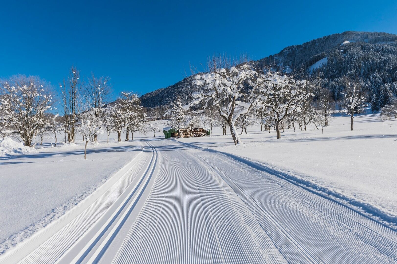
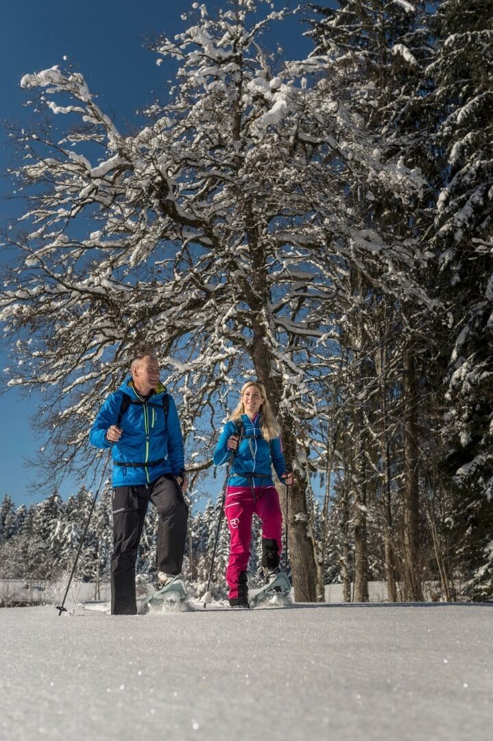
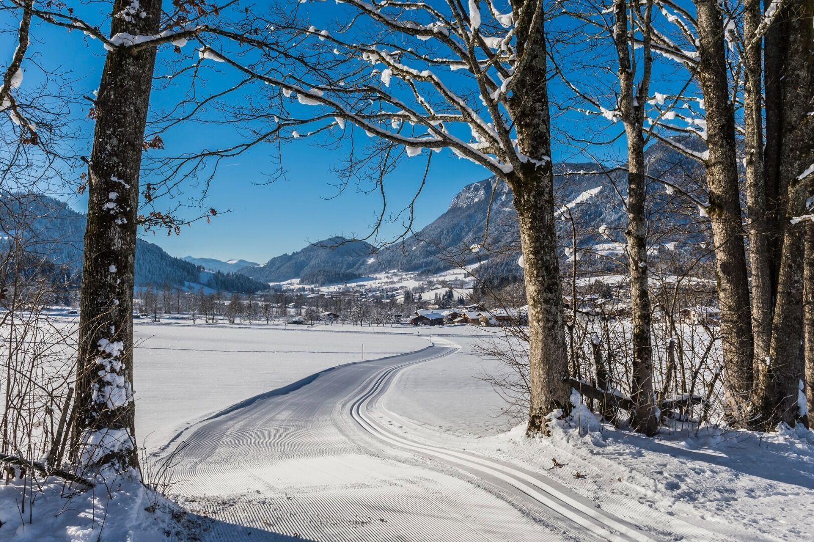
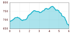
Trudge with your snowshoes from the Ahornsee car park towards the valley station of the mountain railway and continue along the Schattseitweg to the Gasthaus Bocking. You can follow the yellow hiking signs "Scheffau über Schattseite". From Gasthaus Bocking you can take the public bus back to Söll.

Getting here

  • Arrival by public transport

    ski bus stop "Stoll Skicenter"

  • Parking

    Ahornsee car park, Söll (693 m) – free

  • Contact

    Schattseit Schneeschuhtour
    ****

Newsletter

The mountain is calling? So does our newsletter!

In our weekly newsletter we reveal the best holiday tips for Tyrol.