Winter hike Circular route Plangeroß

St. Leonhard im Pitztal /
Difficulty ratings: easy
Route length: 3.5 km
Duration: 0:50 h

Circular route Plangeroß

Tour information

  • Requirement: easy
  • Length: 3.5 km
  • Duration: 0:50 h
  • Elevation uphill:60 hm
  • Elevation downhill:60 hm
Highest point1,619 m

Starting point

Bus stop Plangeroß

Finishing point

Bus stop Plangeroß

Features

  • Circular route
  • Suitable for families

Best time of year

  • January
  • February
  • March
  • April
  • May
  • June
  • July
  • August
  • September
  • October
  • November
  • December

Trail condition

Winter hiking path

Description

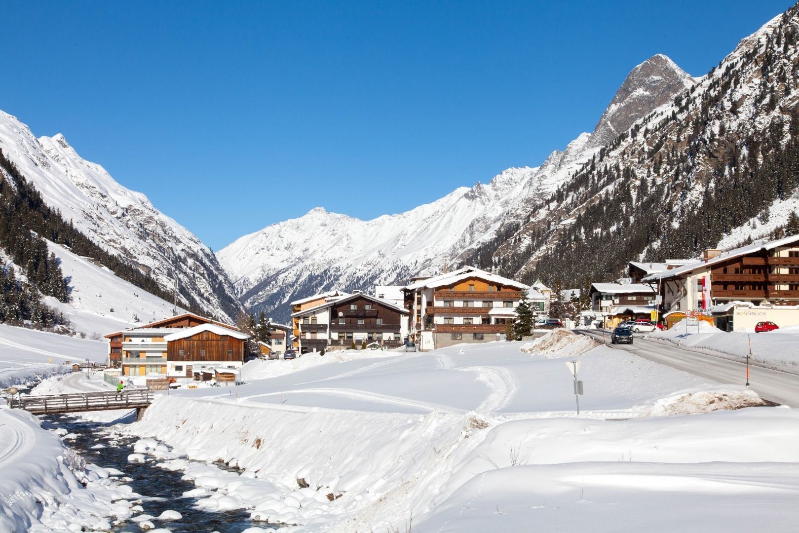
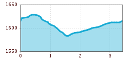
From the starting point (Plangeroß bus stop), walk past the Hotel Sonnblick in a southerly direction. After approx. 100 meters next to the main road, a groomed trail branches off to the left. This trail leads you above Plangeroß in a northerly direction. After crossing the country road, the hike leads to Weißwald to the Sport- & Vitalhotel Seppl, which is a good place to stop for refreshments. The way back is via the cross-country ski trail to just before Plangeroß, where you cross the Pitze via the so-called Pluisteg. Hike past Plangeroß on the right-hand side of the valley and cross the Pitze and the main road at a small forest. From there, head north back to the starting point, the Plangeroß bus stop. 

Newsletter

The mountain is calling? So does our newsletter!

In our monthly newsletter we reveal the best holiday tips for Tyrol.