Trail running The Sill Gorge trail

Innsbruck / Stubaier Alpen
Route length: 6.0 km
Duration: 0:40 h

The Sill Gorge trail

Tour information

  • Length: 6.0 km
  • Duration: 0:40 h
  • Elevation uphill:197 hm
  • Elevation downhill:197 hm

Starting point

Innsbruck, Sonnenburgerhof

Finishing point

Innsbruck, Sonnernburgerhof

Best time of year

  • January
  • February
  • March
  • April
  • May
  • June
  • July
  • August
  • September
  • October
  • November
  • December

Description

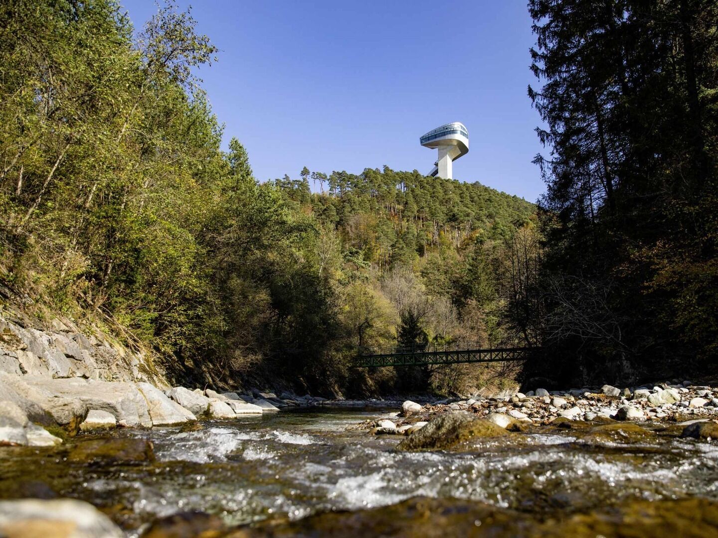
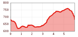
Trail through Innsbruck's most beautiful and shadiest gorge with a view of the Bergisel ski jump.

Start via the wide signposted Panorama Trail in the direction of the Sill Gorge on a partly narrow path. (Attention, wet in places - danger of slipping!). The Sill Gorge ends at a wooden bridge in the district of Gärberbach, from here the trail goes uphill to Natters. The way back then leads downhill over a single trail to the starting point.

Alternatively, you can also start behind the giant circular painting in Wilten. (easy to reach by car or public transport).

Newsletter

The mountain is calling? So does our newsletter!

In our monthly newsletter we reveal the best holiday tips for Tyrol.