
Difficulty:
difficult
Length:
8.3 km
Duration:
3:30 h
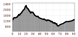
Elevation uphill:
498 m
Verwallumrundung

Start at the Arlberg WellCom and turn right at the roundabout up the old Arlberg road to the main road. Cross this and then turn left into Verwalltal. After the bridge over the Arlenbach stream, you will come to a large meadow where you should take the first turning on the right on the gravel path over a slight climb to the Verwallsee lake and on to the Salzhütte hut. From there, the trail continues to the Konstanzer Hütte. From the bridge in front of the Konstanzer Hütte, turn right through Schönverwall. At the first fork, go straight past the Schönverwallalm. A single trail (Verwall trail) begins there. Cross the Rosanna and then steeply uphill past the Scheid lakes (state border) to the Heilbronner Hütte. From there you ride over the Kops reservoir into the Paznaun valley. From now on you cycle along the well-maintained and very varied valley cycle path to Pians. Then take the main road in the direction of St. Anton am Arlberg. (Loading possibility | Hotel Post | Strengen) In Flirsch take the village road and in Schnann change to the Stanzertal cycle path. From here, the well-signposted cycle path leads along the Rosanna river to St. Anton.


