Fantastic view to the main alpine ridge with glacier and the northern Achensee.
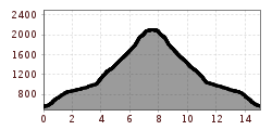
Starting point in Stans is the parking lot at Laurentiuskirche - this is the white/yellow church in the eastern part of Stans of the two churches in Stans. From the parking lot the way is well signposted, please follow the signpost in the direction of St. Georgenberg. A short stretch first goes on an asphalted road to the Maria Tax/St. Georgenberg junction. From here the actual crossroad begins on a comfortable, mostly only slightly ascending forest road.
From the St. Georgenberg/Heuberg/Stanserjoch crossroads, the well-marked path leads to the Stanser Joch. Up geht´s either on the leisurely forest path or via the partly steeply ascending abbreviations of the hiking trail.
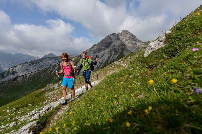
Arrived at the summit cross, a marvellous view over the valley, the main ridge of the Alps and Lake Achensee to the north is rewarded. For the way back you can either take the same route or via the Ochsenkar and the Ochsenkaralm (this alternative is marked "dashed" on the map) down to St. Georgenberg (where you can stop for refreshments) and through the Wolfsklamm.
Please take a small snack and drinks with you, there are no refreshment stops along the way - only at the alternative route!
Stop in Stans im Tal: Landgasthof Brandstetterhof, Landgasthof Marschall or Restaurant Steiner.
")


