Arrival by public transport
Linie: 8327, Haltestelle: Penkenbahn
www.mayrhofen.at/fahrplaene
Start your adventure at the Penken Kombibahn and conquer the Rastkogel at 2.762 meters! The trail takes you over the Wanglspitz through breathtaking mountain landscapes – a challenge rewarded with spectacular views.
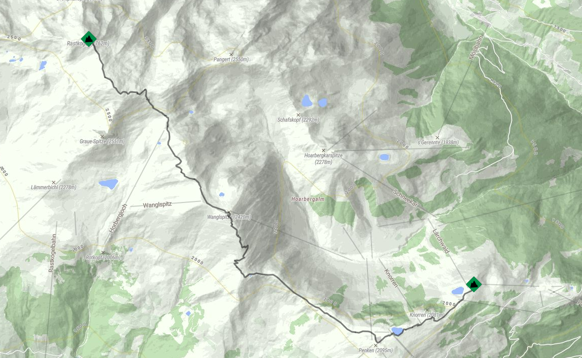
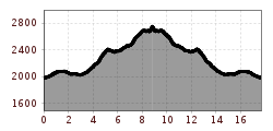
Start your hike at the Penken Kombibahn top station and follow the wide gravel road No. 23 to the left towards Penken/Penkenjoch. From there, trail No. 57 will lead you to Wanglspitz, 2.420 m. At the next junction, take trail No. 51, which will take you to the summit of Rastkogel, 2.762 m. Enjoy the spectacular mountain scenery along the way to your destination. This trail offers both challenge and reward. On the way back, simply follow the same route.
Linie: 8327, Haltestelle: Penkenbahn
www.mayrhofen.at/fahrplaene


 Kasseler Hütte - Edelhütte")
 Berliner Hütte - Greizer Hütte")
 Greizer Hütte - Kasseler Hütte")

