.jpg")
Difficulty:
easy
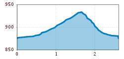
Length:
8.3 km
Duration:
4:30 h
Elevation uphill:
368 m
Walk with a wonderful view of Ried in the Upper Inn Valley
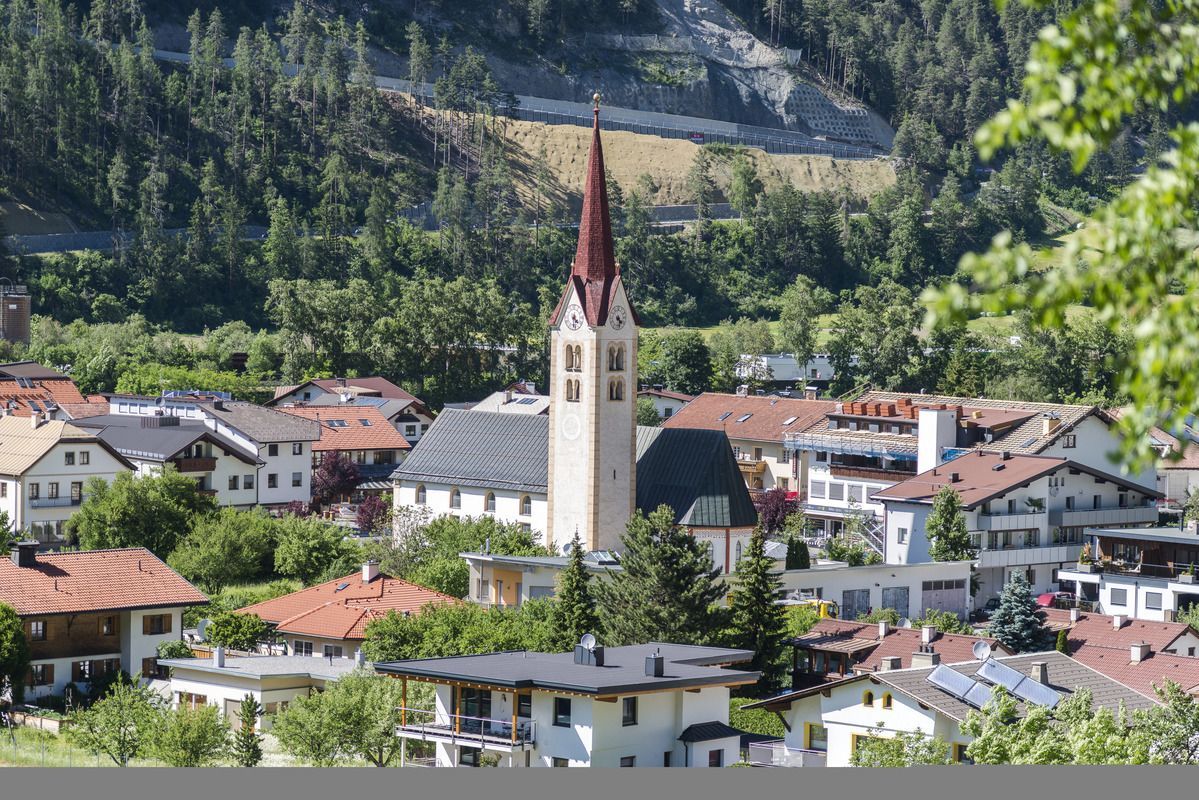

The path leads from the Ried information office along the street to the church "Kapuzinerkirche", where the path branches off to the left and leads via the hamlet of Mühlegg to the Wiener Hütte. Enjoy the view at the Wiener Hütte. From there the path leads down to the Fendlerbach bridge. At the bridge you can cross the road and go down the stairs to get to the starting point. At the foot of the stairs turn left and follow the road, turn right at the village fountain and you are back at the starting point at the information office.
.jpg")
.jpg")
.jpg")
.jpg")
.jpg")
.jpg")
.jpg")
.jpg")
")
.jpg")

.jpg")
.jpg")
.jpg")

.jpg")

.jpg")
.jpg")
.jpg")
.jpg")
.jpg")
.jpg")

