Contact
Andreas Ruech
Hochalmsattel
6108 Scharnitz
+43 720 983554
info@karwendelhaus.com
The Karwendelhaus (1,765 metres) is a well-equipped mountain refuge near the Hochalmsattel in Karwendel, Tirol.
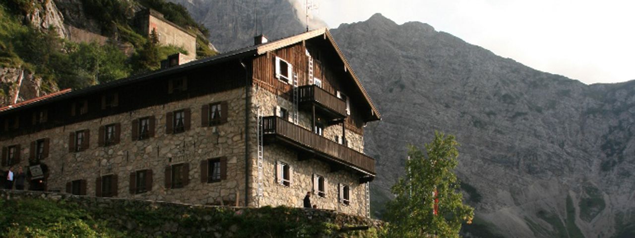

Comfortable mountain refuge high above the Karwendeltal Valley
German Alpine Club, Männer-Turnverein München Division
It merges almost seamlessly in amongst the rocks, the Karwendelhaus in front of the western Ödkarspitze peak, near the Hochalmsattel ridge high above the Karwendeltal Valley. After a construction period spanning five years, it opened in 1908. It is no wonder that it took so long; 4,000 cubic metres of rock had to be shifted using pick axes and dynamite. But the work of the pioneers was certainly worth it. Its central location has already earned it the Environmental Seal of Approval and it is a very well-equipped mountain refuge hut used by mountain climbers as an important base for multi-day hikes in the Karwendel Mountains. It is also a popular day trip destination for mountain bikers. Everyone gets together in the quaint and cosy dining lounge, which is over 100 years old.
From Scharnitz through the Karwendeltal Valley (5 hours), also accessible by mountain bike; from Hinterriß through the Johannestal Valley (4 hours), also accessible by mountain bike; via Rontal, Wechselschneid and Bäralpl, for experienced hikers (7 hours); via Rontal, Steinlochscharte and Bäralpl, for experienced hikers, sometimes no obvious trail, (7.5 hours); via Rontal and Vogelkarscharte, level II climbing difficulty, sometimes no obvious trail (5.5 hours); From Almdorf Eng (5 hours); From Mittenwald via Verein-Alm and Bäralpl (6 hours); from Mittenwald via the Hochland Hut, Gjaidsteig and Bäralpl (7 hours).
Birkkarspitze (2,749 metres), 3.25 hours, difficult
Ödkarspitzen (2,711 metres), 4 hours, difficult
Östliche Karwendelspitze (2,537 metres), 3 hours, difficult
Vogelkarspitze (2,522 metres), 3 hours, difficult
Hochalmkreuz (2,192 metres), 1.25 hours, intermediate
Falkenhütte, 3 hours
Hallerangerhaus, 7.5 hours
Hochlandhütte, 5 hours
Oberes Soiernhaus, 7.5 hours
Pleisenhütte, 8 hours
The Karwendelhaus is the finishing point of Stage 10 and the starting point of Stage 11 of the Eagle Walk, a long-distance hiking trail crossing the region in 33 stages.


