
Difficulty:
medium
Length:
12.2 km
Duration:
6:00 h
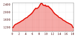
Elevation uphill:
841 m
Kapaunsalm (1911m) - Rifflerkogel (2496m) from Gasthof Talblick (Trail No. 41)
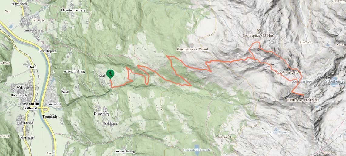
Starting slightly below the Talblick snack station, the hiking trail features a steep ascent alongside the stream (approx. 20 min.) before merging with the forest road. Follow the forest trail as far as a closed meadow gate. Cross a meadow and walk between barns as far as a small wooded area. Turn left at the crossroads and then go straight on to the junction with the path to the Kapaunsalm. Now continue uphill to the right as far as the Kapaunsalm. A well-signposted mountain path runs between Alpine huts, first across the meadows of the Kapaunsalm – before climbing steeply up to the Rifflerkogel. The return journey from Steinkarlsee lake does not feature any notable inclines as it passes the Mannskopf summit and brings you back to the Kapaunsalm. From there, simply follow the trail to the starting point.
stop off possibilities: Gasthof Talblick, Kapaunsalm


.jpg")


")


.JPG")


.JPG")


